
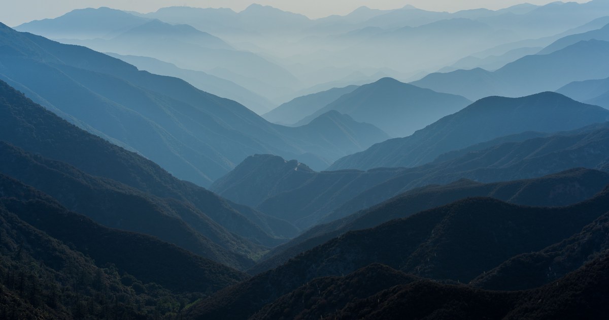
Stand at any wide viewpoint and the ridgelines stack up like cut paper: the nearest one dark green and sharply edged, the next one softer, the one behind that a pale bluish grey, and the farthest barely separable from the sky. Ask why do mountains look blue and most answers stop at the physics. The more useful fact is that the blue is a measurement. It tells you, at a glance and with no equipment, which ridge is in front of which.
Mountains look blue because of the air between you and them. Air molecules scatter short blue wavelengths far more than red, so the deeper the column of atmosphere in your line of sight, the more scattered blue light is laid over the peak, washing out its color and contrast. The rock is not blue. The distance is.
Why do mountains look blue when the rock is grey or green?
The mechanism is Rayleigh scattering, the same effect that makes the daytime sky blue. When light meets particles much smaller than its own wavelength, and nitrogen and oxygen molecules qualify, the amount of scattering rises steeply as wavelength falls. The scattering is inversely proportional to the fourth power of the wavelength, which means blue light is redirected out of the beam dramatically more often than red light.
Two things follow. First, some sunlight that was never headed toward you gets bounced into your line of sight by the air itself. Photographers and atmospheric scientists call this veiling brightness airlight, and it is literally a curtain of blue hung between you and the mountain. Second, the light actually reflecting off the mountain has to fight through that curtain, losing contrast on the way.
So what reaches your eye is a mix: a weak, dimmed image of the peak plus a strong wash of scattered blue. The farther the peak, the more air, the thicker the wash. At extreme range the two converge and the mountain dissolves into the sky entirely.
Painters worked this out long before physicists explained it. The technique is called aerial or atmospheric perspective, and Leonardo da Vinci codified it: distant things lose contrast, lose detail, lose color saturation, and drift toward the hue of the atmosphere. A landscape painted without it looks flat and wrong, because your visual system reads haze as depth automatically.
Turning the haze into a distance ranking
Here is the part the physics explanations leave out. If blue equals depth, you can order a skyline by eye before you name a single summit.
Pick a viewpoint with several ridges visible and rank them by four cues, in this order of reliability:
- Contrast against the sky. The nearest ridge has a hard, dark edge. The farthest has an edge you have to look for. Contrast loss is the strongest distance signal, and the one your eye reads fastest.
- Color saturation. Near slopes keep their real colors: green forest, brown scree, black rock. Far slopes lose saturation and slide toward a flat blue grey.
- Visible texture. At close range you can see individual gullies, tree lines, and snow patches. Those disappear at distance well before the outline does.
- Apparent lightness. Counterintuitively, distant mountains often look lighter than near ones, not darker, because the airlight adds brightness on top of a dim silhouette.
Rank the ridges, and you have a rough depth map. That matters for identification, because the usual failure mode is assigning a name to the wrong layer. A big peak twice as far away can present the same apparent width as a modest one in front of it, and the blue is often the only thing telling you which is which. This is exactly the trap behind most of the peaks people misidentify: the silhouette matches, but the candidate is sitting on a different ridge line.
Combine haze depth with two other free cues and the guesswork shrinks fast. Silhouette gives you the family, whether you are looking at a cone, a horn, a dome or a long ridge, which is the subject of identifying a mountain by its shape. Snow coverage gives you a rough elevation band, covered in reading snow lines. Haze gives you the third dimension the other two cannot supply.
One caution. Because haze depends on your viewing direction as much as on the mountain, the same summit ranks differently from different valleys, which is another version of the problem in why the same mountain looks different from every side. Depth ranking is relative to where you stand, not a property of the peak.
Why the Blue Ridge and the Blue Mountains are named for it
Two mountain ranges are named after this effect, and in both cases the trees add to it.
Along the Appalachians, the National Park Service attributes the range’s name to the bluish haze caused by hydrocarbons released by trees into the atmosphere. The compound most often named is isoprene, a small volatile molecule that oaks, tulip poplars, sassafras and hickories give off in quantity, particularly in summer heat. Once in the air, isoprene and related emissions react and condense into extremely fine particles, and that particle haze reinforces the blue cast the plain air already produces.
Australia’s Blue Mountains, west of Sydney, carry the same story with different trees. Eucalypts are among the world’s heaviest emitters of biogenic volatile organic compounds, and the blue haze over the Grose Valley is generally attributed to atmospheric chemistry driven by those emissions. It is worth keeping the scientific hedge here: CSIRO researchers found that air quality models had been overestimating eucalypt isoprene output by roughly a factor of six, likely because the emission rates came from young trees under seven years old. The trees clearly matter; exactly how much they contribute is still being refined.
The distinction worth carrying is that these ranges are not blue for a separate reason. They are blue for the ordinary reason, plus an extra load of naturally produced fine particles that deepens the effect and made it striking enough to name.
When the blue cue lies
Haze is a good distance proxy, not a reliable one. Four situations break it.
Exceptionally clear, dry air. After a front clears through, the airlight thins and far ridges snap into focus. Mountains that normally read as three layers deep can look one layer away. The NPS notes that visibility in eastern parks improved from around 50 miles in 2000 to around 70 miles in 2015, and in western parks from around 90 to 120 miles, which is a reminder that “how far you can see” is a variable, not a constant.
High humidity. The reverse case. The EPA notes that some particles, sulfates in particular, scatter more light in humid conditions. A muggy summer afternoon can make a nearby ridge look genuinely distant, which is why your depth ranking should always be made among ridges visible at the same moment, never against a memory of how the view looked last week.
Wildfire smoke. This one inverts the color logic. Smoke particles are large compared with air molecules, so they scatter across the spectrum rather than favoring blue. Distant ridges under smoke turn grey, brown, or orange instead of blue, and they lose contrast far faster than distance alone would explain. When the haze is not blue, stop using it to judge distance.
Human-made haze. Along the Blue Ridge, the NPS reports that visibility in the Southern Appalachians has fallen 40% in winter and 80% in summer over the past 50 years because of man-made pollutants, with the mountains themselves trapping and concentrating them. The EPA is blunt on the point: most haze in US parks is not natural, it is air pollution. The result is a view that reads as deeper than it is.
From haze to a name
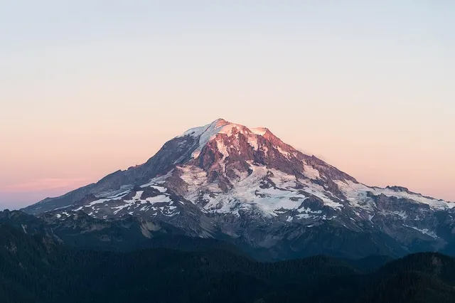
Once you have ranked the ridges, you still need names. That is the moment the guessing stops being fun. Point your camera at the skyline and Mountain Identifier returns the summit with its elevation, prominence and range, so you can check your reading of the haze against the real distances. On a clear day above a stack of blue ridges, that quick confirmation turns a pretty view into a map you can read. Do it a few times from a familiar viewpoint, and the layers start naming themselves before you lift the phone. Look at Mount Rainier from an urban skyline sometime, pale and floating and apparently weightless, and you will see the whole effect at work in a single peak.
The real peaks
Genuine photographs of the summits above — so you know what to actually look for:
Sources
- Air Quality at Blue Ridge Parkway (National Park Service)
- Visibility (National Park Service)
- Basic Information about Visibility (US Environmental Protection Agency)
- Beating the Eucalypt Blues: New Ways to Model Air Quality (CSIRO)
- Blue Mountains National Park (NSW National Parks and Wildlife Service)
- Aerial perspective (Wikipedia)
- Rayleigh scattering (Wikipedia)