The white on a mountain isn’t decoration — it’s data. The height where rock gives way to snow encodes the peak’s elevation, the local climate, the season, and even which way a slope faces. Learn to read it and the question “what is the snow line on a mountain” turns into one of the most useful identification tools you can carry, because it works from any distance with no equipment at all.
The snow line on a mountain is the elevation above which snow persists — all year round in the case of the permanent (climatic) snow line, or temporarily in the case of the seasonal one. It sits near 4,500 m (15,000 ft) at the equator, just below 3,000 m (9,800 ft) in the Alps, and at sea level near the poles.
The snow line on a mountain is really two lines
The first thing to separate is permanent snow from seasonal snow.
The permanent snow line is the level above which snow survives the whole year — above it, more snow falls each year than melts, which is why glaciers live up there. It’s set by climate and moves only slowly, over decades.
The seasonal snow line is wherever the current snow cover happens to end today. In winter it can plunge far below the permanent line — sometimes to the valley floor — then climb back up through spring and summer as the melt proceeds. By late summer, in most ranges, the seasonal line has retreated close to the permanent one, and what’s left is glacier and firn.
This is why the same peak photographs white to the ankles in January and nearly bare in September. Neither photo lies; they’re two positions of the same moving boundary.
What sets the height: latitude first
The dominant control is latitude, because latitude sets temperature. Near the equator the climatic snow line runs around 4,500 m (15,000 ft); in the mid-latitude Alps it sits just below 3,000 m (9,800 ft); toward the poles it descends all the way to sea level. In dry subtropical ranges it can overshoot the equatorial figure — parts of the Himalaya hold their permanent snow line as high as 5,700 m (19,000 ft), because scarce snowfall is as decisive as warm air.
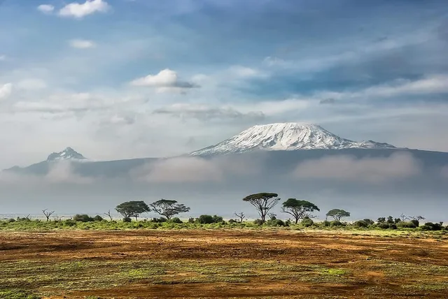
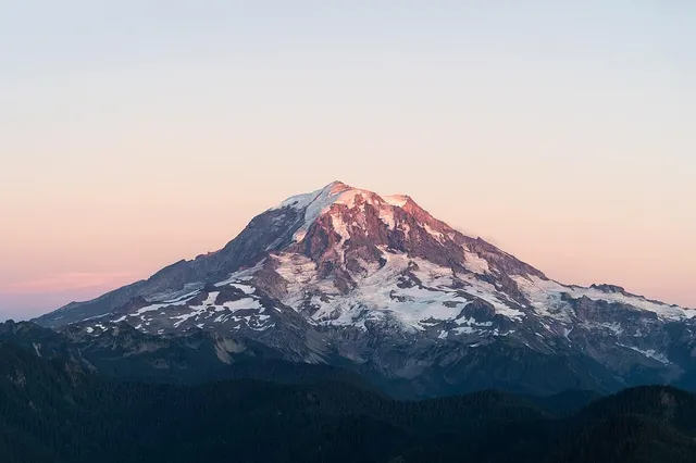
Two famous peaks bracket the idea nicely. Kilimanjaro stands three degrees south of the equator, so despite its 5,895 m (19,341 ft) of height only its uppermost reaches hold ice — the mountain rises out of hot savanna and has to climb four and a half kilometres before permanent white becomes possible. Mount Rainier, at a much more modest 4,391 m (14,406 ft) but sitting near 47°N in a very snowy maritime climate, is armoured in glaciers far down its flanks. Less mountain, more ice — latitude and snowfall, not elevation, decide the wardrobe.
The fine print: aspect and exposure
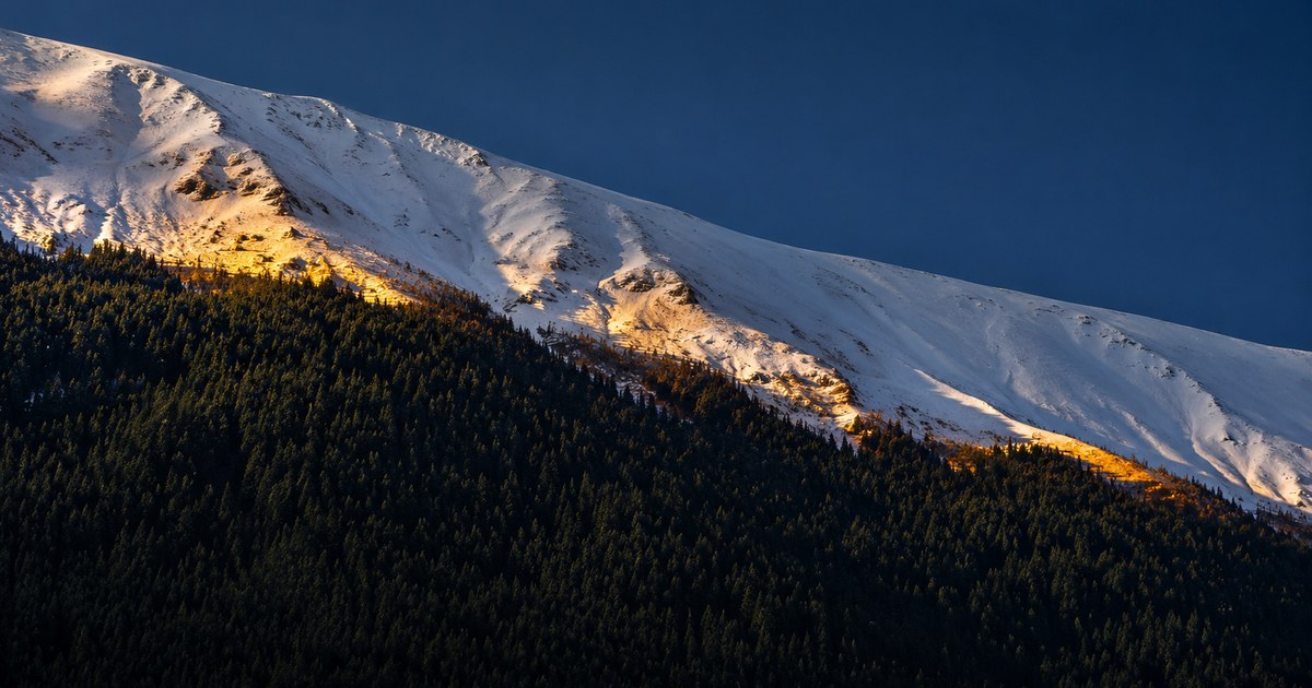
Zoom in on a single mountain and the snow line stops being a neat horizontal ring. In the Northern Hemisphere, north-facing slopes hold snow to lower elevations than south-facing ones, because they catch less sun; in the Southern Hemisphere the pattern flips. Wind matters too — gusts strip snow from exposed ridges and pile it into sheltered hollows, so lee slopes and gullies stay white while windward crests blow bare.
For an identifier, aspect is a free compass. If you’re looking at a range in summer and one flank of each peak carries visibly more snow, that snowier side is probably the shaded, poleward side — north-facing in Europe or North America. That can help you orient a photo whose direction you don’t know.
Using the snow line to size up a peak
Here’s the practical rule of thumb. Anchor three numbers — roughly 4,500 m at the equator, roughly 3,000 m in the mid-latitudes, sea level near the poles — and interpolate for where you’re standing. Then:
- A peak carrying summer snow clears the local snow line. If you’re in the Alps in August and a summit is convincingly white on top, that summit very likely exceeds roughly 3,000 m. In the tropics, year-round white means something far taller.
- A bare peak in late summer probably doesn’t. Absence of white by September usually puts a mid-latitude summit below the permanent line — useful for ruling out candidates.
- In winter and spring, trust the line’s position less. Seasonal snow reaches far downhill, so a white summit tells you little. What still helps is relative coverage: the peak holding snow lowest on its flanks is usually the highest or most shaded of the group.
- Crisp white with visible crevasses or blue ice means glacier, not fresh snowfall — a sign of terrain above the permanent line regardless of season.
Combine that with silhouette — the ridgelines, cones and horns we cover in identifying a mountain by its shape — and you can often narrow a skyline to one or two candidates before reaching for your phone. (None of this is weather or route judgment, to be clear — it’s a spotting trick for naming peaks, not for deciding where to walk.)
Let the mountain confirm it
The snow line gets you to a good hypothesis; the app gets you to a name. Point the camera at the skyline and it identifies the summit outright, with its elevation alongside — so you can check your estimate and calibrate your eye for next time. After a few rounds of guess-then-verify, you’ll find you can read a horizon’s heights from the white alone, which is a quietly excellent party trick on any clear day in the mountains.
The real peaks
Genuine photographs of the summits above — so you know what to actually look for: