Long before you can read an elevation sign or open an app, a mountain has already told you something about itself. Its silhouette is a fossil of the forces that built it — and learning how to identify a mountain by shape means learning to read five basic outlines that repeat on skylines all over the world.
To identify a mountain by its shape, match the silhouette to one of five families: a smooth symmetrical cone points to a stratovolcano, a faceted pyramid to glacial carving, a rounded dome to solid rock stripped bare by erosion, a flat top to resistant horizontal strata, and a knife-edge ridge to glaciers cutting in from both sides at once.
Each shape below comes with a famous example and, more importantly, the reason the shape exists. That second part is what most shape lists skip — and it’s what makes the skill stick, because once you know why a cone is a cone, you’ll never confuse it with a horn again.
The cone: a volcano that built itself
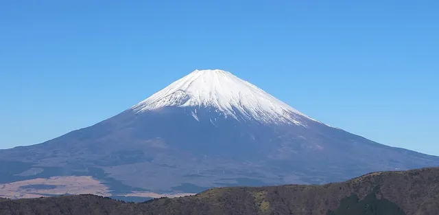
A near-perfect cone with smoothly steepening sides is the signature of a stratovolcano — a mountain constructed, eruption by eruption, from its own layered ash and lava. The textbook case is Mount Fuji, Japan’s highest mountain at 3,776 m (12,389 ft), an active stratovolcano that last erupted in 1707–1708. Its famous symmetry is no accident: material erupted from a single central vent settles evenly in all directions, so the mountain grows outward like a pile of poured sand.
The tell-tale details: a cone stands alone or in a loose chain rather than inside a dense range, its profile is concave (gentle at the base, steep near the top), and the summit is often truncated by a crater. If you spot that outline on a horizon, you are almost certainly looking at a volcano — construction, not carving.
The horn: a pyramid carved by glaciers
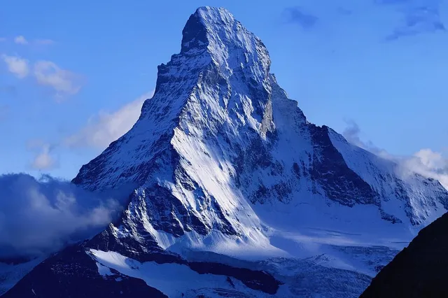
Where the cone is built, the pyramid is subtracted. A glacial horn forms when three or more glaciers gnaw into the same peak from different sides. Each glacier excavates a bowl-shaped hollow called a cirque; where the cirque headwalls intersect, they leave a steep, faceted pyramid of rock standing between them.
The world’s most famous horn is the Matterhorn, 4,478 m (14,692 ft) on the Swiss–Italian border — so definitive that geologists simply call the landform a “horn” after it. Its four dramatic faces are the headwalls of the glaciers that spent the last ice ages eating the mountain from every side.
The tell-tale details: sharp, planar faces meeting in distinct ridges, a pointed summit, and neighbors with the same hacked-at look. Horns live in ranges that were heavily glaciated — the Alps, the Himalaya, the Rockies — never standing alone on a plain the way volcanic cones can.
The dome: bare rock shedding its skin
A smooth, rounded summit of exposed rock usually means you’re looking at a dome — a single body of hard rock, often granite, laid bare as everything softer around it eroded away. Yosemite’s Half Dome, 2,694 m (8,839 ft), is the classic example: the solidified remains of a deep magma chamber, uncovered by uplift and erosion. Its curved shape comes from exfoliation — the outer rock peeling off in curved slabs, like layers of an onion — a process the USGS notes shaped the summit even though glaciers never overtopped it (they did, however, help quarry away its famous sheer face).
The tell-tale details: rounded rather than pointed, massive and unbroken rather than craggy, and typically pale bare rock. Domes signal old, deep-formed rock and long, patient erosion — no volcano and no ice cap required for the curve itself.
The mesa: a mountain with its top sliced off
A summit that runs dead flat, edged by steep cliffs, is a plateau mountain or mesa — horizontal layers of erosion-resistant rock protecting the softer layers beneath. Cape Town’s Table Mountain is the emblem: its level summit plateau, topped out at 1,086 m (3,563 ft) at Maclear’s Beacon, is held up by a cap of extremely hard quartzitic sandstone that erodes far more slowly than the surrounding landscape. The land around it wore down; the table stayed.
The tell-tale details: a horizontal skyline, cliff bands running level like layers in a cake, and often a family of smaller flat-topped remnants nearby. Where a cone says “volcano” and a horn says “ice”, a mesa says “hard flat strata plus deep time.”
The arête: a ridge sharpened from both sides
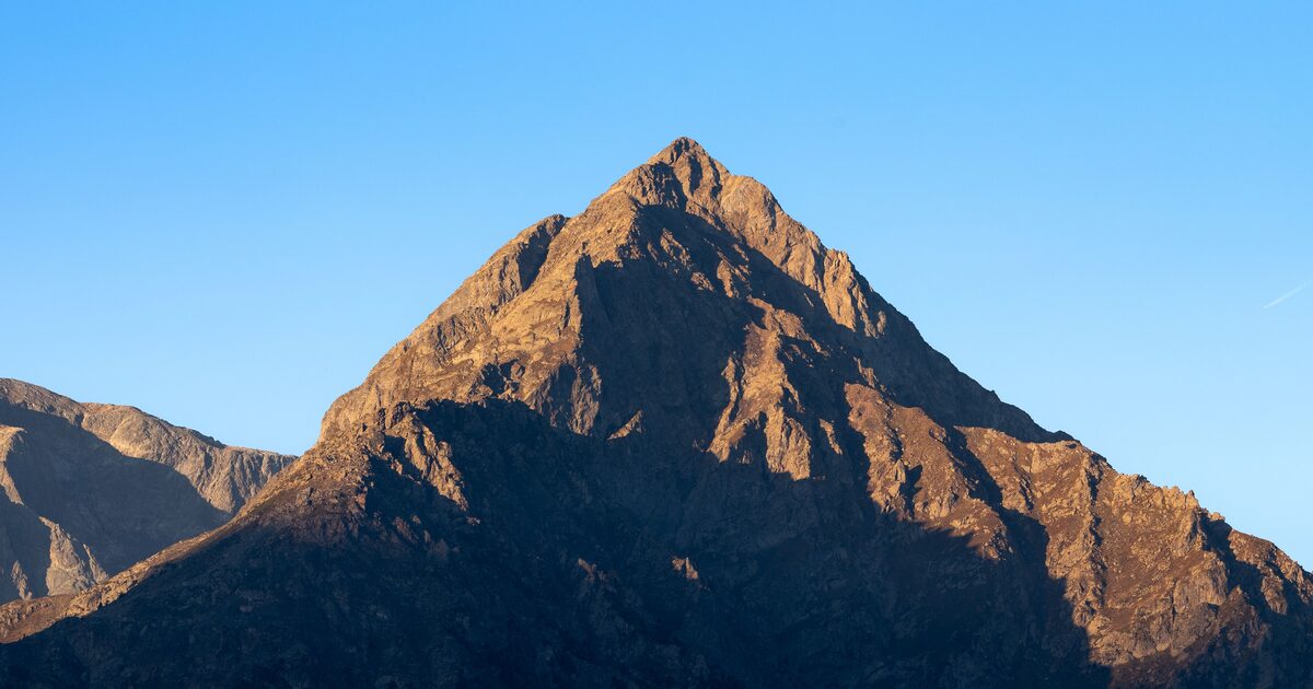
Finally, the knife-edge. An arête is what remains when two glaciers carve parallel valleys or back-to-back cirques on either side of the same wall of rock, thinning it into a serrated blade. Wales offers a famous small-scale example: Crib Goch, a knife-edged arête reaching 923 m (3,028 ft) in Eryri (Snowdonia), sharpened during the last ice age by glaciers working both flanks at once.
The tell-tale details: a long, narrow, jagged crest connecting summits, often with scooped bowls (the old cirques) visible below on either side. Arêtes and horns are siblings — both are glacial subtraction — which is why they so often appear on the same skyline.
Putting the taxonomy to work
Shape narrows the field fast, and that’s the practical trick: a cone on a plain and a horn in a range are different geological stories, so they’re different candidate lists. From there, our guide to how to identify a mountain adds the other clues — position, elevation, prominence, and what else shares the skyline — and the app closes the case: point your camera at the silhouette and it names the peak, with height, range and a confidence score attached. Read the shape first, though. It’s the part of the answer the mountain has been holding up for a million years.
The real peaks
Genuine photographs of the summits above — so you know what to actually look for: