
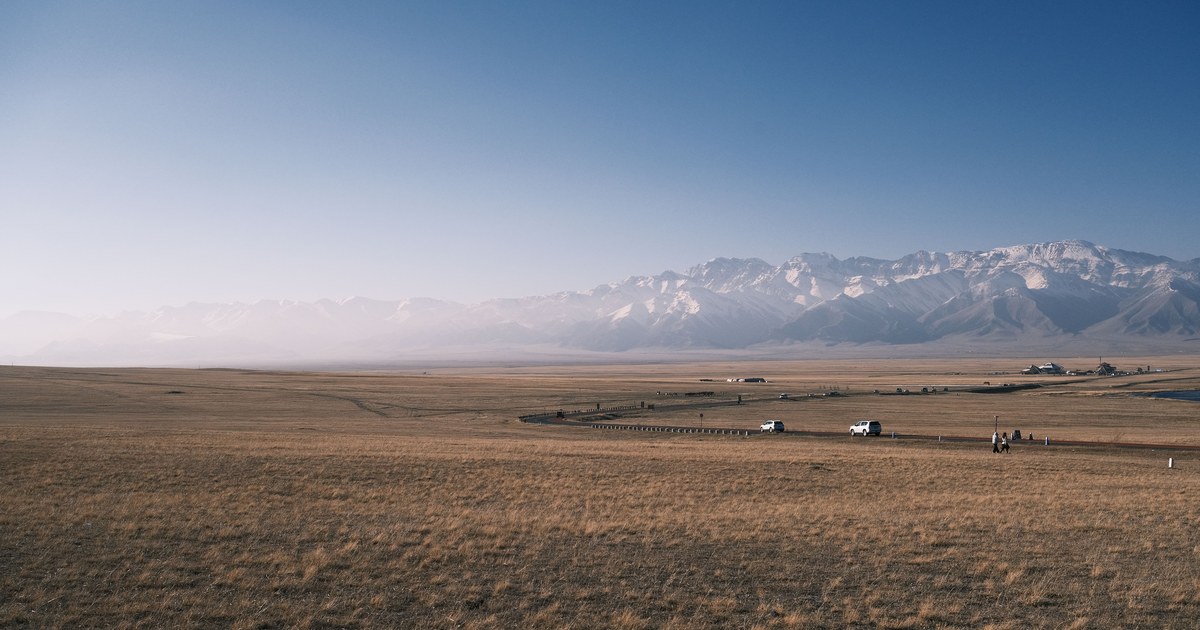
From a beach, the edge of the sea sits less than five kilometres away. From that same beach, a snow summit two hundred kilometres inland can stand clear above the haze, sharp enough to photograph. So how far away can you see a mountain? The geometry has a clean answer you can work out in ten seconds. What decides the real answer, on the day you are actually standing there, is the air.
A mountain of height h metres can in principle be seen from up to about 3.57 times the square root of h kilometres away, which is roughly 237 km for a 4,400 m peak. Standard atmospheric refraction adds around eight percent to that. In practice, haze usually cuts the distance long before the curve of the Earth does.
Most explanations stop at the first sentence. The rest of this article is the part that matters when you are squinting at a horizon wondering whether that pale triangle is a mountain or a cloud.
How far away can you see a mountain from its height alone?
The core formula is short. For an eye or a summit at height h metres above sea level, the distance to the geometric horizon in kilometres is:
d ≈ 3.57 × √h
In imperial units, the distance in miles is about 1.23 times the square root of the height in feet. Both come from the same piece of school geometry: a line of sight that grazes a sphere of radius R touches it at a distance of roughly √(2Rh), and plugging in an Earth radius of 6,371 km produces the 3.57 constant.
Some quick numbers. An adult’s eye at 1.7 m sees a horizon about 4.7 km away. A 100 m coastal bluff pushes that to 36 km. A 1,000 m hill reaches 113 km. The square root is the reason climbing costs so much for so little: quadrupling your height only doubles your reach.
What changes when you are standing somewhere high too?
Almost every real sighting involves two heights, not one. You are somewhere above sea level, and so is the summit. The two horizons meet, so you add them:
d ≈ 3.57 × (√h₁ + √h₂)
Take a viewer on a 100 m bluff looking at a 3,000 m peak. That is 3.57 × (10 + 54.8), or about 231 km of geometric reach, against 196 km for a viewer at sea level. Gaining a hundred metres of your own bought you about 36 km.
This is also why the answer to “can I see it from here” is never a property of the mountain by itself. It belongs to the pair of points, which is why the same summit disappears from one town and dominates the next one up the valley.
Why refraction adds about eight percent
Here is the correction that the geometry-only explanations leave out. Air is denser near the ground, so a horizontal light ray does not travel in a straight line. It bends gently downward, following the planet’s curve instead of escaping it.
Under an average atmosphere the ray curves about one seventh as sharply as the Earth’s surface does. Surveyors handle that by pretending the planet is bigger than it is: an effective radius of about 7/6 of the true value, roughly 7,440 km. Run the same formula with that number and the constant moves from 3.57 to about 3.86. Standard refraction, in other words, buys you around eight percent more distance for free.
The honest caveat is that “standard” is a fiction. Refraction varies day to day and place to place, and it is most unruly in the first few metres above a surface, where temperature gradients are steepest. The refracted figure is accurate to a few percent most of the time and occasionally wildly wrong, which is exactly why record sightings and mirages both exist.
Haze decides it long before the curve does
Geometry tells you whether a peak is above your horizon. It says nothing about whether you can pick it out. That second question is visual range, defined by the National Park Service as the greatest distance at which an observer can see a black object against the sky.
The limit is contrast, not size. Sunlight scattered by the air between you and the mountain piles up along the sight line and washes the summit toward the colour of the sky behind it. Enough of that and the peak is still geometrically visible and completely invisible in practice. The same scattering is what makes distant ridges recede into pale blue layers, a process worth understanding on its own if you want to read depth in a skyline: see why mountains look blue.
What loads the air is aerosols. The NPS lists sulfates, nitrates, sea salt, organics, elemental carbon, fine soil and coarse particles as the main contributors, and notes that fine particles scatter light more efficiently than large ones. Humidity makes it worse, because many of those particles swell as they take on water and scatter more strongly. A humid summer afternoon in a polluted airshed can cut visual range to a few tens of kilometres while the horizon formula still promises you two hundred.
Strip the aerosols out entirely and there is still a floor: the air molecules themselves scatter light. That is the theoretical ceiling on how far anyone can ever see, and almost nobody is ever anywhere near it.
Worked examples at real scale
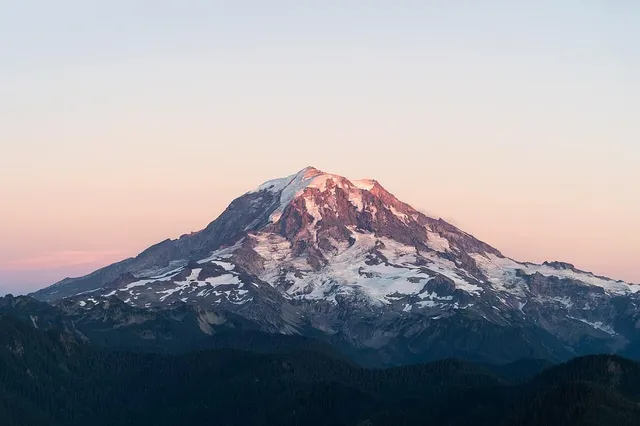
Mount Rainier rises to 14,410 ft (about 4,392 m) according to the National Park Service. Its geometric horizon is 3.57 × √4392, or about 237 km, stretching to roughly 256 km once you allow for refraction. Seattle sits well inside that at around 95 km, which is why the mountain is a permanent feature of the city’s skyline whenever the air is clean, and why locals talk about the mountain being “out” rather than being there. It is always there. The air is the variable. We mapped more of these city-and-summit pairings in which US cities have a mountain on the skyline.
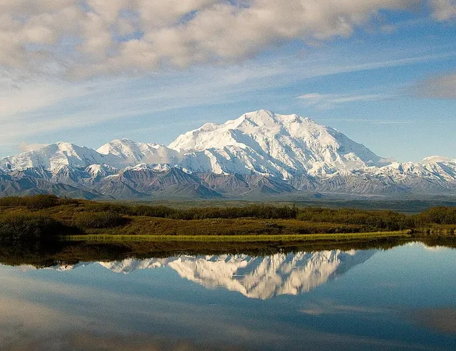
Denali is listed by the NPS at 20,310 ft (about 6,190 m), giving a geometric horizon near 281 km and a refracted one past 300 km. That is why the peak can be picked out from populated southern Alaska more than two hundred kilometres away on the handful of genuinely clear days each season, and why so many visitors never see it at all.
The best worked example is a photograph. On 16 July 2016 Marc Bret shot Pic Gaspard in the Écrins from the summit of Pic de Finestrelles in the Pyrenees, a line of sight of 443 km. Finestrelles stands at 2,826 m and Pic Gaspard at 3,883 m. Feed both into the two-point formula and the pure geometry gives about 412 km, which is less than 443. The refracted version gives roughly 446 km, which is just enough. That shot is not a demonstration of Earth’s curvature. It is a demonstration of refraction, taken from a point where the geometry alone forbids it. The current Guinness World Records mark for the longest line of sight ever photographed is 493.07 km, set by Richard Jezik in December 2024.
Why the records happen in cold, dry, stable air
Look at what the record hunters have in common. Bret’s frame was made at dawn. Jezik’s was made at about -12°C in strong wind. Neither is a coincidence.
Cold air holds less water vapour, so the aerosols in it stay small and scatter less. Wind and a well-mixed air mass prevent the stagnant layers where haze accumulates, which is why a front clearing through beats a week of settled summer weather. Low sun near sunrise puts the distant peak in silhouette against a bright sky, which maximises the contrast that visual range is measured by. And a smooth vertical temperature profile keeps refraction steady and slightly generous instead of turbulent, so the image holds together at extreme magnification.
Put plainly: the best long-distance viewing days are cold, dry, windy and early. The worst are warm, humid, still and midday. That single sentence will predict your chances better than any formula on this page.
What all this means when you are looking at a skyline
The maths gives you a ceiling and the air gives you the day’s actual answer, and between the two you get the moment every view-chaser knows: a pale silhouette floating above a hundred kilometres of haze, unmistakably a mountain and completely anonymous. The same problem shows up at 11,000 m, where a whole range slides past the wing and nobody on board can name it, as we found writing about mountains you can see from an airplane window.
Distance is exactly what makes naming hard. Depth cues collapse, the shape flattens, and the peak you can see is often not the nearest one. This is where pointing a camera beats squinting: the app matches the outline against terrain data, and hands back a name, an elevation and a range rather than a guess, which is also why how apps identify a mountain from a photo is mostly a story about geometry rather than pattern recognition. You worked out that the summit is within reach. Finding out which one it is takes about a second.
The real peaks
Genuine photographs of the summits above — so you know what to actually look for:
Sources
- Distance to the Horizon — Andrew T. Young, San Diego State University
- Horizon — Wikipedia
- How We Measure Visibility — National Park Service Air Resources
- Mount Rainier National Park — National Park Service
- Denali National Park and Preserve — National Park Service
- Longest Line of Sight on Earth Photographed — Guinness World Records
- Pic de Finestrelles to Pic Gaspard, 443 km — Beyond Horizons
- Pic Gaspard — Wikipedia
- Pic de Finestrelles — Wikipedia