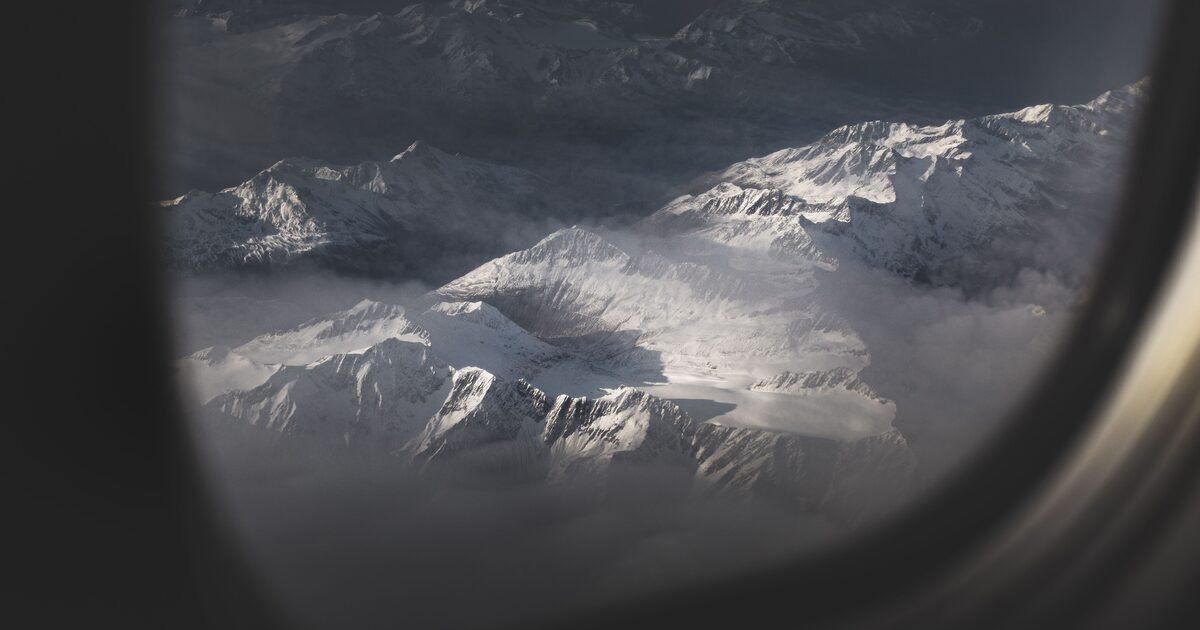
Most people’s best-ever mountain view didn’t happen on a trail. It happened in seat 32A, forehead against the plastic, somewhere over a range they couldn’t name. A cruising airliner is an 11,000 m (36,000 ft) observation deck, and on the right routes the mountains you can see from a plane include the biggest on Earth.
On clear days, ordinary commercial flights offer some of the best mountain views anywhere: Denali on Anchorage approaches, the Alps on flights between northern Europe and Italy, and the Himalaya — including Everest — along Delhi–East Asia routes. Sit on the side of the plane facing the range, follow the moving map, and remember that the biggest-looking peak is not always the highest one.
The physics are on your side. From typical cruising altitude, simple line-of-sight geometry puts your horizon several hundred kilometres away — far enough that a truly huge mountain can hang in your window for twenty minutes or more. The hard part isn’t seeing a giant; it’s knowing which giant you’re seeing.
Denali from the air: Anchorage approaches and the northbound corridor
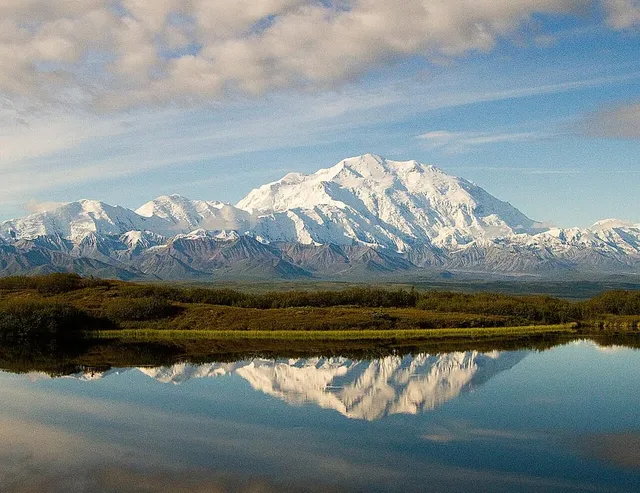
Denali is the easiest world-class summit to catch from a scheduled flight, because at 6,190 m (20,310 ft) with roughly 6,100 m of rise over its surroundings, it towers over everything else in North America. On a clear day it’s visible from Anchorage itself, roughly 200 km (about 125 mi) away — so aircraft descending into Anchorage from the Lower 48 often get it as a white wall on the northern horizon.
Which window? It depends on the exact routing and the day’s air-traffic pattern, so treat any seat advice as odds, not a promise. The pattern that holds most often: Denali sits north of Anchorage, so on the common southeast-to-northwest arrivals from Seattle it tends to appear on the right side of the aircraft. On the short northbound hop between Anchorage and Fairbanks, which passes the Alaska Range, the usual guidance is left side flying north, right side flying south. Alaska’s flightseeing operators follow the same logic on their small-plane tours out of Talkeetna and the park area.
One warning from the statistics: Denali makes its own weather and hides in cloud much of the time. If it’s out, look immediately — don’t wait for the drink cart to pass.
The Alps from above: crossings into Italy and beyond
Any flight that connects northern Europe with Italy or the western Mediterranean — London, Amsterdam, Frankfurt or Paris down to Milan, Rome, Venice, Nice — has a good chance of crossing the Alps, and some long-haul arrivals from North America into southern Europe cross them too. Unlike Denali, this isn’t one peak but a 1,000 km arc of them, so both sides of the plane can win.
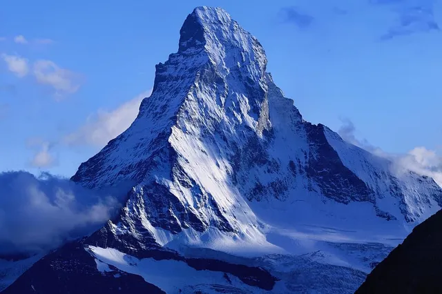
The two summits worth hunting for are Mont Blanc, at 4,805.59 m (15,766 ft) by the 2023 survey the highest in the Alps, and the Matterhorn, whose 4,478 m (14,692 ft) pyramid is unmistakable even from cruising altitude — a single dark fang in a sea of white ridges. Routes toward Milan and Turin often pass close to the western Alps where both live; routes toward Venice favor the Austrian and Dolomite side instead. Because routings shift daily, the moving map is your friend: when it shows Geneva or Turin nearby, start scanning.
The Alps also reward the cheap seats. Even when you can’t pick out a specific summit, the crossing itself — glaciers, ribbon valleys, whole villages in shadow — is the best fifteen minutes in European aviation.
The Himalaya from Delhi–East Asia routes
The heaviest hitters appear on flights linking India with East and Southeast Asia. Routes from Delhi toward Bangkok, Hong Kong, Shanghai or Tokyo generally run south of the Himalayan crest, which parks the highest mountain range on Earth off one side of the aircraft — the north side, which flying eastbound means the left. Coming back westbound, it’s the right. As always, exact routings vary, so treat this as the default rather than a guarantee.
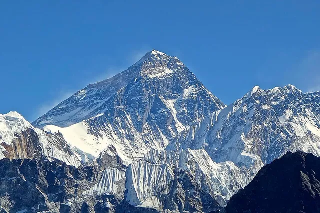
What can you actually see? On a clear day, an astonishing amount: an unbroken white rampart floating above the haze line, often for the better part of an hour. Mount Everest itself — 8,848.86 m (29,031.7 ft) — is plausible from a surprising distance, and passengers regularly photograph it from scheduled flights. Note that not every “Himalaya route” delivers it: the popular Delhi–Kathmandu hop, for instance, approaches Kathmandu from the west while Everest stands well to the east, so travelers hoping for it on that leg usually come away disappointed. Nepal’s airlines also run dedicated one-hour “mountain flights” from Kathmandu that fly along the range purely for the view, with Everest typically shown to the left side outbound and the right side on the return.
How to tell which mountains you can see from a plane
Naming a summit from seat 32A is a genuine identification problem — you’re moving at 900 km/h and the perspective is one no guidebook photo uses. Four habits help.
First, use the moving map before the mountain appears, not after. Knowing you’re passing Geneva, Talkeetna or the Nepal border tells you which giants are even candidates.
Second, judge peaks by how much they rise above their neighbors, not by summit height. From the air, prominence is what you actually see: Denali and the Matterhorn leap out of the window precisely because they stand clear of everything around them.
Third, note the time and your heading. A photo with a timestamp plus the flight number is enough to reconstruct roughly where you were — which is often enough to settle an argument about which peak is in frame.
Fourth, let the phone do the hard part. Snap the peak through the window, and the app will match the skyline and name the summit with its elevation, prominence, range and country — no cell signal over the Karakoram required for the memory to survive until landing. The same trick works after the fact on any photo in your camera roll.
However you fly it, take the window seat. The middle-seat passenger gets an armrest; you get Denali.
The real peaks
Genuine photographs of the summits above — so you know what to actually look for: