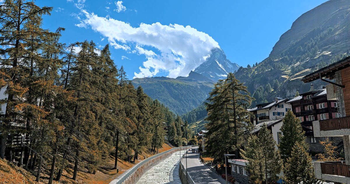
Everyone shoots the same Matterhorn photo: the church bridge in Zermatt, the peak framed between chalet roofs. It’s a fine picture — and it’s also the one every other visitor already has. The best views of the Matterhorn are mostly above and around the postcard, and a couple of the finest cost nothing at all.
The best views of the Matterhorn outside Zermatt’s village postcard are the Gornergrat ridge at 3,089 m, the Riffelsee reflection below Rotenboden, and the Italian town of Breuil-Cervinia on the mountain’s south side. The lake and Cervinia can be reached on free hiking trails or village streets; Gornergrat itself normally means a paid cog-railway ticket.
A quick honesty note before the list: “free viewpoint” and “free to reach” are different things. The mountain never charges admission, but the classic high-altitude platforms are served by a railway that very much does. Below, each spot says plainly which is which.
Gornergrat: the grandstand seat (paid to ride, free to stand on)
Gornergrat is a rocky ridge at 3,089 m (10,135 ft) facing the Matterhorn across the valley, with a supporting cast of glaciers and 4,000 m summits arranged around it. The cog railway that climbs there from Zermatt opened in 1898 and is the highest open-air railway in Europe — a genuinely spectacular ride, and a genuinely expensive one. There is no entry fee at the top; the ticket is the cost.
The budget version is honest work: the hiking trails that switchback up from Zermatt through Riffelalp and Riffelberg are free, and strong walkers do the whole climb. Most people compromise — ride up, walk down — which still buys you hours of Matterhorn-facing trail for a one-way fare.
From Gornergrat the Matterhorn is unmistakable, but the skyline is crowded with other giants, and this is exactly where confident misidentifications happen. The Monte Rosa massif to the east contains higher summits than the Matterhorn itself, and first-time visitors regularly photograph the wrong peak. Pointing the app at the skyline settles it in seconds, with elevation and prominence for whichever summit you’re actually framing.
Riffelsee: the reflection shot
One stop below the summit, at Rotenboden station (about 2,815 m / 9,236 ft), a ten-minute downhill path reaches Riffelsee — the small tarn behind half of the Matterhorn images you’ve ever seen. On a calm morning the peak reflects cleanly in the water; by midday, wind usually ripples the mirror away. Early is better, and mornings here are cold even in July.
Access follows the same logic as Gornergrat: the train to Rotenboden is paid, the lake itself is free, and the trails reaching it on foot are free. If you’re already walking down from Gornergrat, Riffelsee is directly on the way — the rare world-famous photo spot that requires no detour.
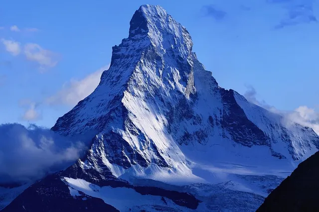
The reflection works because of geometry worth noticing: the Matterhorn is a freestanding pyramid of 4,478 m (14,692 ft) with no near neighbour to clutter its outline, which is a big part of why it sits near the top of our list of the most recognizable mountains on Earth. Very few famous peaks give you a clean, isolated silhouette and a still lake at the right distance.
The Italian side: Breuil-Cervinia, the free grandstand
Cross the border (or drive around it) and the same mountain becomes Monte Cervino, looming over the resort town of Breuil-Cervinia at about 2,050 m (6,730 ft) in the Valtournenche, Aosta Valley. Here the economics flip: the view from the town and the meadows around it is completely free, all day, no ticket — the mountain simply fills the head of the valley.
The catch is that it barely looks like the same mountain. Zermatt sees the sharp, slightly hooked fang; Cervinia faces the broad south wall, a steeper, bulkier, more fortress-like face. Plenty of travelers photograph Monte Cervino and genuinely wonder whether it’s the Matterhorn at all. It is — same summit, different side — and this is the cleanest real-world lesson in why a peak’s shape belongs to a viewpoint, not to the mountain.
Lifts above Cervinia climb toward the high glacier country for a fee, but unlike the Swiss side you don’t need them for the classic view; the town is the viewpoint.
Timing the light
Whichever side you choose, the clock matters as much as the coordinates. The faces looking toward Zermatt and Gornergrat catch the morning sun, which is why sunrise on the Gornergrat side is the photographers’ pilgrimage and why Riffelsee works best before the wind wakes up. Cervinia’s south wall, by contrast, holds good light through the middle of the day. And on many afternoons the summit manufactures its own drama: wind tearing over the isolated pyramid often draws out a streaming banner of cloud from the peak — spectacular to watch, inconvenient if you arrived for a clean silhouette. Patience is a viewpoint too; the cloud frequently burns off or blows through within the hour.
Choosing among the best views of the Matterhorn
If you want the crowd-free reflection, go early to Riffelsee. If you want the full amphitheatre of glaciers, pay for Gornergrat once and walk down. If you want the best free-per-franc ratio of all, sleep in Cervinia, where the show is visible from the main street. Distance viewing has its own charm too — on exceptional days high points far into the surrounding ranges can pick out the Matterhorn’s profile, the same long-range game we cover for Fuji in seeing Mount Fuji from Tokyo.
Wherever you stand, the failure mode is the same: a skyline full of white summits and a confident guess. The fix is also the same. Point your camera, let the app name the peak, and check the number — 4,478 m, Pennine Alps, Switzerland–Italy border — before you caption the photo. The Matterhorn is the most recognizable mountain in the Alps, and it is still misidentified daily by people looking at Monte Rosa. For the rest of the range, see the best places to see the Alps.
The real peaks
Genuine photographs of the summits above — so you know what to actually look for: