Search for the best places to see the Alps and page one hands you tour itineraries. Ten-day loops, coach transfers, a booking button. That is a different question from the one most people are asking, which is simpler: where can I stand, in normal clothes, and have several thousand metres of rock and ice directly in front of me. The Alps have been answering that question for a century and a half, because the region built an enormous amount of infrastructure specifically so that people who do not climb could still see the view.
The best places to see the Alps without climbing are the ones somebody else already engineered: cog railways to Gornergrat and the Jungfraujoch, cable cars to the Aiguille du Midi and the Zugspitze, lakeshores at Lucerne and Geneva, and city terraces in Milan and Innsbruck. Every one of them is reachable in ordinary shoes.
What follows is organised by how you get there rather than by prestige, with a note on each about what you actually see and how often you actually see it.
Trains: the railways built for the view
Switzerland industrialised sightseeing before anyone else. Europe’s first mountain railway opened on 21 May 1871, climbing from Vitznau on the shore of Lake Lucerne up the Rigi, built by the engineer Niklaus Riggenbach against a good deal of scepticism. Rigi is still the gentlest introduction to an Alpine panorama in existence: the massif is almost entirely ringed by water, with Lake Lucerne, Lake Zug and Lake Lauerz below it, and the horizon to the south is the wall of the Bernese and Central Swiss Alps. It is a modest 1,800 m summit doing the work of a much bigger one, because nothing blocks it.
The famous one is the Jungfraujoch, at 3,454 m the highest railway station in Europe. The cog railway climbs from Kleine Scheidegg through a tunnel bored inside the Eiger and the Mönch, and the alternative approach uses the Eiger Express cableway from Grindelwald to cut the journey to roughly an hour and a half. What you see at the top is not really peaks: it is the Aletsch Glacier, at about 23 km the longest glacier in the Alps, curving away below the observation platforms in a way that no photograph prepares you for.
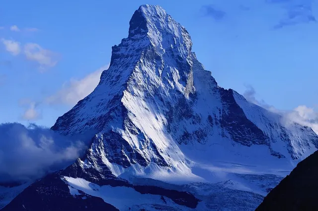
Gornergrat above Zermatt is the third of the classic railway grandstands, and the only one of the three where the star of the show is a single unmistakable object. The Matterhorn stands across the valley at 4,478 m, a freestanding pyramid with nothing beside it to confuse the outline. We covered that mountain’s viewpoints in detail, including the free ones, in the best free viewpoints for the Matterhorn.
Lifts: the fastest altitude you can buy
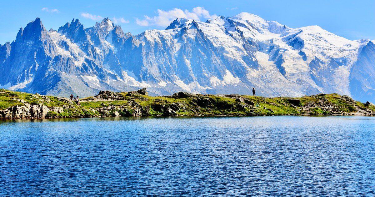
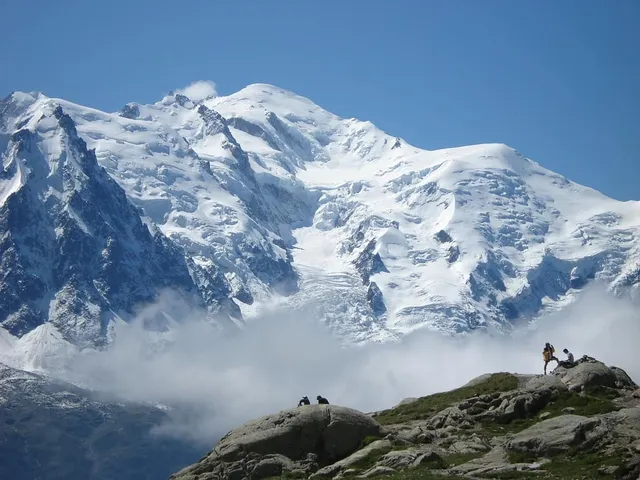
The Aiguille du Midi cable car above Chamonix is the single most efficient view in the Alps. Twenty minutes from the town centre puts you at 3,842 m, a vertical ascent of 2,807 m from the valley floor, which is a world record for a cable car. The terrace gives a 360 degree panorama of the French, Swiss and Italian Alps, with Mont Blanc itself filling the view to the south.
Two things are worth knowing about that Mont Blanc view. The first is that from the Aiguille du Midi you are looking at a whole mountain group rather than one summit, which is why the words “Mont Blanc massif” get used so loosely: the distinction between a peak and the block of terrain it belongs to is genuinely useful here, and we unpacked it in what a massif actually is. The second is that the height keeps moving. The summit is a snow and ice dome, surveyed every couple of years, and the September 2023 measurement put it at 4,805.59 m, more than two metres below the 2021 figure. That story is in why the roof of the Alps changes height every year.
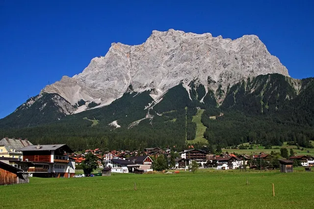
Germany’s contribution is the Zugspitze, 2,962 m and the country’s highest point, with three separate mechanical ways to the top. The Bayerische Zugspitzbahn cog railway has been running since 1930 and climbs from Garmisch-Partenkirchen via Grainau and the Eibsee to the Zugspitzplatt at 2,588 m, where a glacier cable car finishes the job. The Seilbahn Zugspitze goes straight from the Eibsee to the summit in one span. From Austria, the Tiroler Zugspitzbahn comes up from Ehrwald. The summit view takes in more than 400 peaks across four countries, which is a lot of skyline and, honestly, a lot of unidentifiable skyline.
Innsbruck deserves a special mention because it collapses the whole category. The Nordkettenbahnen run three linked sections, the Hungerburgbahn funicular out of the city centre and then two cable cars to Seegrube and Hafelekar at 2,256 m. The trip takes about twenty minutes from the middle of town, climbing roughly 1,700 m. You look back down over the Inn valley and the rooftops, with the Stubai Alps forming the wall on the far side. No other city in the Alps puts high alpine terrain that close to a tram stop.
Lakeshores: the free viewpoints
Water does something for mountains that no platform can. It doubles them, and it gives your eye a flat foreground to measure the height against, which is why lake views read as bigger than the same peaks seen from a hillside.
The northern shore of Lake Geneva, from Lausanne round through Vevey and Montreux, faces a genuine mountain wall: the Chablais Alps and the multiple summits of the Dents du Midi standing above the far side of the water. Lake Lucerne does the same job at closer range with Rigi and Pilatus rising directly out of it, and the lake steamers are effectively a moving viewpoint. In Italy, the northern arms of Lake Como and Lake Garda run straight into the mountains, so the view up the lake is a receding stack of ridges. In Slovenia, Lake Bled sits under the eastern edge of the Julian Alps with Triglav behind it.
None of these cost anything, none require a booking, and all of them work from a bench.
City terraces and valley towns
You do not have to leave the city. The roof terraces of the Duomo in Milan, run by the Veneranda Fabbrica, are a walkway among the spires and statues high above the piazza, and on a clear day the Alpine arc is on the northern horizon. Turin has the same relationship with the Cottian and Graian Alps, visible from the riverside and the hills above the city, with Monviso’s distinctive pyramid often picked out first. Munich sits far enough north that the Alps appear only occasionally, but when a föhn wind clears the air the chain shows up from high ground in the city, and locals treat it as an event.
These are the views where identification becomes genuinely hard, because you are seeing a hundred kilometres of ridgeline compressed into a strip a few degrees tall.
Honest expectations: which views actually deliver
Tour listings never tell you the failure rate, so here it is in plain terms.
The high stations are the gamble. The Jungfraujoch at 3,454 m and the Aiguille du Midi at 3,842 m are both high enough to be inside the weather rather than beneath it, which means an overcast day does not give you a moody view, it gives you white. Both operators publish live summit webcams for exactly this reason, and looking at one before you buy a ticket is the single highest-value thing in this article.
Mid-height viewpoints are the reliable ones. Rigi, Innsbruck’s Nordkette and the lakeshores sit below most cloud bases and still deliver, which makes them the sensible choice on an uncertain day.
Summer afternoons are the weakest time almost everywhere. Warm, humid, stagnant air loads the sight line with haze and washes out anything distant, and convection builds cloud around the big summits as the day goes on. The clearest long-distance views tend to come early in the morning, and in the days behind a front when cold dry air has moved in. That is doubly true for the city views: the Alps from Milan or Turin are a winter and shoulder-season phenomenon far more than a summer one.
Light matters as much as clarity. The Matterhorn’s Zermatt side takes the morning sun. Mont Blanc from Chamonix works better later in the day. A viewpoint facing into the sun gives you a silhouette, which is atmospheric but strips the detail that makes a peak recognisable.
Naming what you are looking at
Here is the part every one of these viewpoints has in common. The single-summit views are easy: nobody stands at Gornergrat wondering which one is the Matterhorn. The panoramas are the problem. Four hundred peaks from the Zugspitze, the whole Alpine arc from a Milan roof, an unbroken wall of white from the Aiguille du Midi, and almost none of it labelled. Panorama boards help when they exist and when you are standing exactly where the artist stood, which you usually are not.
It is the same puzzle we ran into looking down at ranges from cruising altitude in mountains you can see from an airplane window: plenty of mountain, no names attached. The fix is the same in both places. Point the camera at the skyline, let the app match the outline against the terrain, and get back a name, an elevation and a range for the summit you were actually looking at. You came a long way for that view. It is worth knowing what it is called.
The real peaks
Genuine photographs of the summits above — so you know what to actually look for:
Sources
- Jungfraujoch — Top of Europe
- Aiguille du Midi Cable Car — Chamonix-Mont-Blanc Tourist Office
- Zugspitze: Tips for the Highest Mountain in Germany — muenchen.de
- Zugspitze, Top of Germany — Bayerische Zugspitzbahn Bergbahn
- Innsbrucker Nordkettenbahnen — Tirol Tourist Board
- History of the First Mountain Railway of Europe — Rigi Bahnen
- Duomo di Milano — Veneranda Fabbrica del Duomo
- Matterhorn — Wikipedia
- Mont Blanc — Wikipedia