
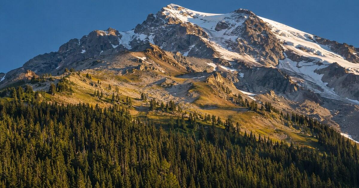
Look at almost any big mountain from a distance and you will see it divided in two. The lower slopes are dark and textured with forest. Somewhere above them the texture stops, and the upper mountain is bare rock, grass, scree or snow. Ask what is the tree line and that boundary is the answer, and once you start noticing it, it becomes one of the most useful lines on any skyline.
The tree line is the highest elevation at which trees can grow on a mountain. Above it, the growing season is too cold and too short for upright trees, so forest gives way to shrubs, alpine meadow and rock. Its altitude is set mainly by summer warmth, which is why it is high in the tropics and low near the poles.
That last point is what turns a botanical fact into a reading skill. The same line sits at very different heights around the world, and its position on the slope in front of you says something about where you are and how big the mountain really is.
What is the tree line, exactly?
In ordinary speech “the tree line” means one line. Ecologists split it into a few. The timberline is the upper edge of closed forest, where the trees still stand shoulder to shoulder. The tree line proper runs a little higher, through the last upright trees growing in scattered groups. The German-language forestry portal waldwissen.net draws the distinction the same way: the timberline limits the closed forest, while the tree line includes the highest upward-growing tree.
Above that, trees can survive only by giving up on being trees. In Rocky Mountain National Park the U.S. Geological Survey describes the treeline zone, roughly 3,350–3,650 m (11,000–12,000 ft), as a place where subalpine fir and spruce grow more horizontally than vertically, forming low islands called krummholz, German for “crooked wood”. Well-established krummholz there can be hundreds of years old, occasionally a thousand.
From a distance, the whole transition compresses into a single visible band. The dark forest thins, breaks into patches and then disappears. That band is what you are reading when you look at a mountain and say “tree line”.
Why do trees stop growing at a certain height?
The short answer is heat, and specifically heat during the growing season.
In 2004 the ecologists Christian Körner and Jens Paulsen published the results of a worldwide campaign in which temperature loggers were buried in the root zone at 46 treeline sites between 68° N and 42° S. Their finding was striking: despite the enormous differences between those mountains, the natural treeline sat at a remarkably similar seasonal mean ground temperature, around 6.7 °C, with little variation from site to site. The University of Basel group behind the work summarises it as treelines following a common temperature threshold largely irrespective of latitude.
Their explanation is that trees at the limit are not short of sugar from photosynthesis. They are short of warmth to turn that sugar into new wood. A tree holds its crown up in the cold, moving air, unlike a low alpine plant that hugs the warmer ground, so it is the first plant form to run out of usable summer.
An older rule of thumb from climate classification makes the same point from the other side: forest generally gives out where the mean temperature of the warmest month falls below about 10 °C. Both versions say the same thing. The tree line is a temperature line drawn on the land.
Local factors bend it. Treelines tend to sit higher in the interior of big mountain ranges than on their outer edges, a pattern called the Massenerhebung (mass elevation) effect: a large block of high ground warms the air above it and shelters it from wind. Avalanche paths, rockfall, fire, grazing and thin soils can all push the visible line far below the climatic limit, which is why tongues of bare slope often run down into the forest.
How high is the tree line around the world?
Because the controlling temperature is similar everywhere, the altitude of the tree line mostly tracks how warm a region is. A few real numbers:
- The Alps: waldwissen.net puts the upper limit of forest as low as about 1,800 m on the exposed outer peaks of the Pre-Alps, rising to around 2,500 m in the sheltered central valleys of the Valais and the Engadin.
- The Colorado Rockies: in Rocky Mountain National Park the National Park Service puts the start of the alpine tundra at about 3,350–3,500 m (11,000–11,500 ft), depending on exposure, and roughly a third of the park lies above the limit where trees can grow.
- The subtropical and tropical high mountains: the University of Basel group cites treeline on Mexican volcanoes at around 4,000 m.
- Southern Tibet: a 2007 study reported a stand of Tibetan juniper at 4,900 m, the highest treeline found in the Northern Hemisphere.
- The far north: toward the Arctic the line keeps falling, until the forest stops altogether at the Arctic tree line, even at sea level.
Using the tree line to read a mountain
This is where the line earns its place in a spotter’s toolkit.
It is a built-in scale bar. On a hazy skyline it is very hard to judge how big a mountain is. But if you know roughly where the tree line sits in that region, you can estimate how much mountain rises above it. A peak in the Alps whose bare upper half looks as tall as its forested lower half is a very different animal from a hill that is wooded to the top. A summit that is forested all the way up, in a region where trees quit at 2,000 m, is telling you it is lower than that.
It tells you roughly where you are. A mountain with trees up to 3,500 m is not in Scotland. A treeless ridge at 1,000 m probably is not in the tropics.
It survives summer. Snow cover comes and goes through the year, and the snow line can move by hundreds of metres in a month; our guide to reading snow lines covers that moving boundary. The tree line moves over decades rather than weeks, so it is the more stable landmark for recognising a mountain in any season. When a familiar peak suddenly looks unfamiliar in August, look for the forest edge rather than the snow.
It helps sort ridges front to back. Forest reads as dark and textured close up and fades to a smooth blue-grey with distance. A ridge whose tree cover is still individually visible is close; one that has become a flat tone is far. That haze effect is explained in why mountains look blue.
It changes with aspect, sometimes. On a single mountain the line can sit at different heights on different faces, pushed down on one side by avalanches or wind and not on another. That is one reason the same peak can look surprisingly different from two valleys, as we explored in why a mountain looks different from every side.
Tree line and shape together
Tree line pairs naturally with silhouette. A rounded summit that is wooded to the top reads as a hill or a low range; a sharp rock pyramid that rises far above a clear forest edge reads as high mountain terrain. Put the two together with the shapes described in how to identify a mountain by its shape and you can often narrow a distant summit down to a handful of candidates before you look at a map.
When you want the final answer, point your camera at the peak and the app will name it, with the elevation that tells you how far above the trees it really stands.
Sources
- A world-wide study of high altitude treeline temperatures (Körner and Paulsen, Journal of Biogeography, 2004)
- High elevation treeline — Department of Environmental Sciences, University of Basel
- Alpine Tundra Ecosystem — Rocky Mountain National Park, National Park Service
- Ecology of Rocky Mountain National Park — U.S. Geological Survey
- Where trees can no longer grow: the alpine timberline — waldwissen.net
- Highest Treeline in the Northern Hemisphere Found in Southern Tibet (Miehe et al., Mountain Research and Development, 2007)
- Massenerhebung effect — Wikipedia
- Tree line — Wikipedia