Walk a valley around any big peak and you’ll notice something unsettling: the mountain you photographed at breakfast doesn’t look like the mountain above you at lunch. Ridges migrate, faces widen, the summit seems to lean a different way. This is the single biggest reason people misname peaks — and the core of why mountains look different from different sides.
Mountains look different from different sides because a summit is a three-dimensional mass and your eye only ever sees one projection of it. Each viewpoint lines up different ridges and faces, foreshortening compresses whatever slopes point toward you, and light picks out different features — so the silhouette genuinely changes with your bearing.
Once you understand the three effects doing the work — aspect, foreshortening, and light — you can stop being fooled by them, and even use them to nail an identification.
Aspect: why the same mountain looks different from each side
A mountain isn’t a flat cut-out; it’s a pyramid, a dome, or a heap of ridges. What you see is the outline of that mass projected against the sky from where you stand, and rotating around it swaps one outline for another.
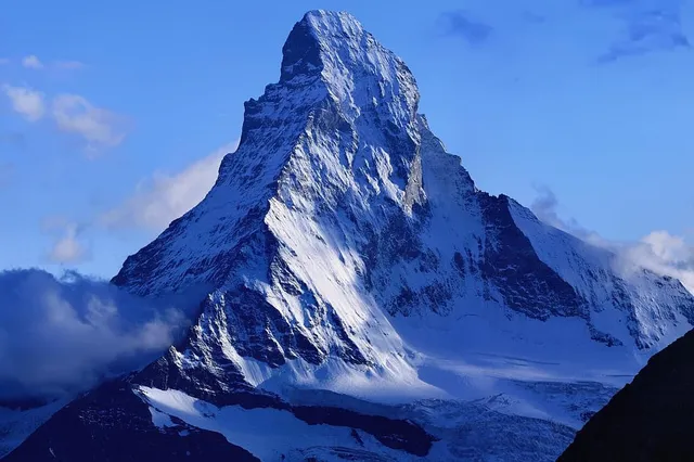
The Matterhorn is the textbook case. Its 4,478 m (14,692 ft) summit sits on the Swiss–Italian border with four steep faces separated by four ridges — the Hörnli, Furggen, Zmutt, and Lion. From Zermatt on the Swiss side you look at the mountain roughly along the Hörnli ridge, so the east and north faces stack into that impossibly sharp, slightly hooked pyramid — the chocolate-wrapper silhouette everyone carries in their head. Cross to Breuil-Cervinia on the Italian side and the same mountain reads broader and blockier: you’re now facing the south side, the Lion ridge takes over the skyline, and the famous bent fang becomes a massive tooth. Both views are honest. Neither is “the” Matterhorn.
Lesser-known peaks behave the same way with less fame to correct you. A summit that’s a clean cone from the west can be a long, boring whaleback from the north, because you’re now looking down the length of its main ridge instead of across it. Twin summits merge into one from certain bearings and split apart from others.
Foreshortening: the slope pointing at you disappears
The second effect is stealthier. When a slope inclines toward you, its whole length compresses into a narrow band in your field of view — kilometres of mountainside flatten into what looks like a short step. Photographers know this as foreshortening, and it’s why the view up a face from its base always looks tamer than the view of the same face from across the valley.
For identification, foreshortening does two damaging things. It shrinks near peaks relative to far ones, so a modest summit ten kilometres away can tower over a giant forty kilometres away. And it hides the features you’d use to recognize a mountain: that distinctive hanging glacier or summit notch may be pointed straight at you and compressed to invisibility. From one valley you see a peak’s full sweep; from the next valley over, half its height is folded away.
Light: the same rock, redrawn every hour
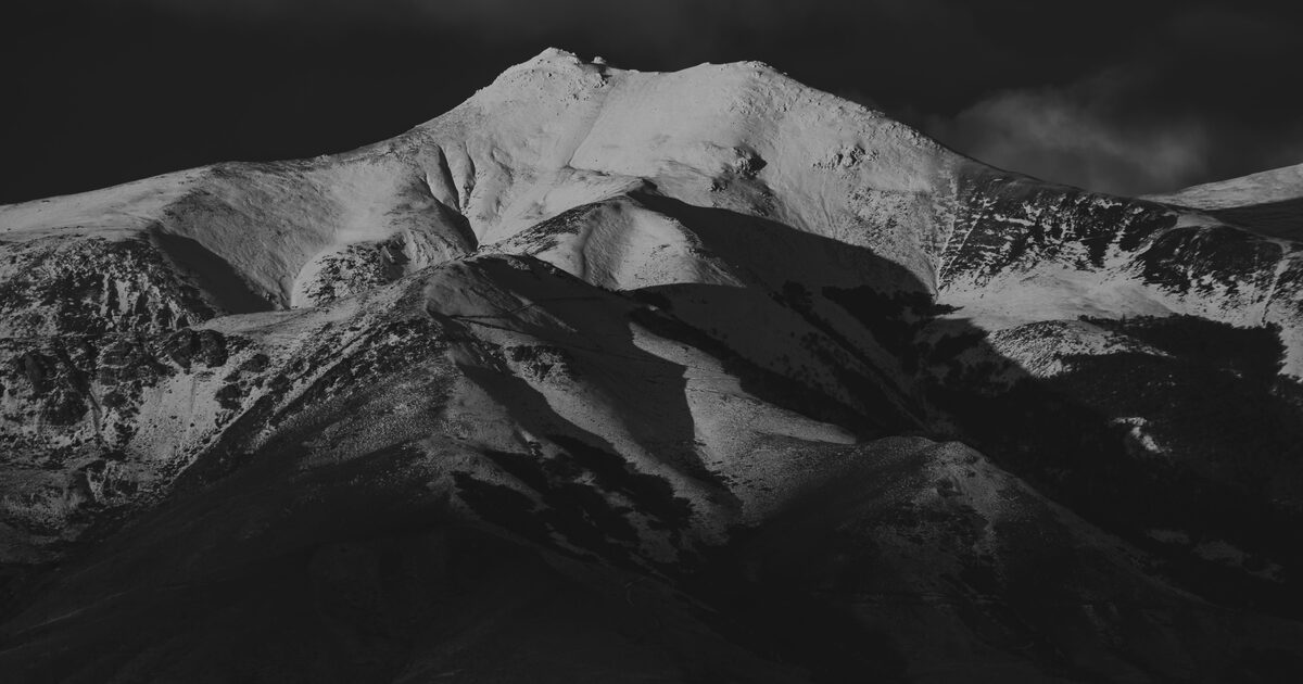
Finally, mountains are drawn by shadow as much as by shape. A ridge that faces morning sun is a bright wall at 9 a.m. and a black silhouette at 6 p.m.; gullies vanish at noon when the light goes flat and reappear as dark ink when it rakes across the face. Snow makes it stronger still — a north face can hold snow and read “white mountain” while the sunny side of the same summit is bare rock. Two photos of one peak, taken from the same spot at different hours, can look like two different mountains. Add a different season and even locals hesitate.
Why this matters for photo and AR identification
Any identification method — a friend who knows the range, a guidebook panorama, or a camera app — is really matching what you see against a stored idea of the mountain. If the stored idea is “the Matterhorn as seen from Zermatt” and you’re standing in Italy, naive shape-matching fails, because the shapes genuinely don’t match.
That’s why serious identification has to reason about viewpoint, not just outline. Given where you’re standing and the direction you’re facing, there is exactly one way each candidate peak can project onto your horizon. Mountain Identifier works this way: it takes your position and bearing, builds the horizon that terrain must produce from that spot, and matches your photo against it — so the Italian Matterhorn and the Swiss Matterhorn are both, correctly, the Matterhorn. Our guide to identifying any mountain walks through the whole method.
The flip side: a photo with no location attached is genuinely ambiguous. Friends send a zoomed skyline shot with “which peak is this?” and the honest answer is often “from where?” — the same silhouette can be produced by different mountains from different places.
A field method: note your bearing before you shoot
You can make every mountain photo identifiable with ten seconds of discipline:
- Note where you are. A dropped pin, a trail junction name, or just “lakeshore at the north end” — any anchor for your viewpoint.
- Note your bearing. Phone compasses are plenty: “looking roughly southwest” cuts the candidates dramatically. Photos with location metadata capture much of this automatically.
- Shoot wide once. A frame with foreground and neighbouring summits preserves context that a tight zoom throws away; relative positions of peaks are often more diagnostic than any single shape.
- Distrust the profile, trust the lineup. One silhouette can mislead; the left-to-right order of summits on a horizon from a known bearing almost never does.
If you learn shapes deliberately — and our guide to identifying mountains by shape is built for exactly that — learn them per side: “the Matterhorn from Zermatt” and “the Matterhorn from Cervinia” are two entries in your mental catalogue, not one.
The deeper lesson is oddly satisfying. A mountain has no single true face — it has as many as there are places to stand. Once you carry that idea with you, changing angles stops being a source of confusion and becomes the fun part: every new pass, flight, or valley hands you a portrait almost nobody else has bothered to learn.
The real peaks
Genuine photographs of the summits above — so you know what to actually look for: