
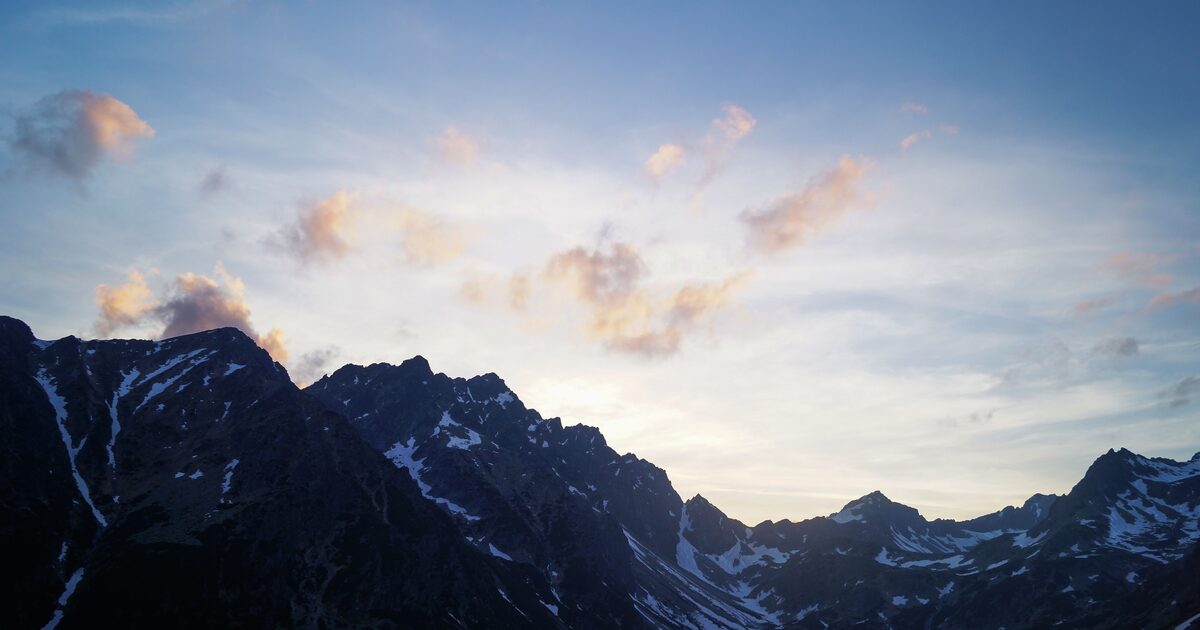
Some mountains get photographed under the wrong name every single day. Famous shapes breed lookalikes, and the most commonly misidentified mountains are victims of their own silhouettes: every sharp horn becomes “the Matterhorn,” every snowy cone becomes “Fuji,” and — in the cruelest case — the actual summit gets upstaged by a nearer, lower neighbor in its own family portrait.
The most commonly misidentified mountains are lookalikes of famous shapes: glacial horns mistaken for the Matterhorn, symmetrical stratovolcanoes mistaken for Mount Fuji, Cascade volcanoes mistaken for Mount Rainier, Nuptse photographed as Everest, and the Dôme du Goûter mistaken for Mont Blanc’s summit. Each mix-up has one visual tell that settles it.
This is a companion piece to our guide on identifying a mountain by its shape: shape gets you to a family, but within a family you need the tell. Here are five, with theirs.
The Matterhorn and the world’s other horns
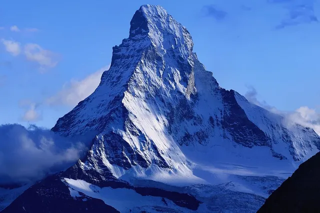
The Matterhorn — 4,478 m (14,692 ft) above Zermatt — is the archetype of the glacial horn, a pyramid carved by glaciers grinding away at all sides at once. The trouble is that glaciers did the same thing all over the world. Mount Assiniboine, about 3,618 m (11,870 ft), is routinely called the Matterhorn of the Rockies; Ama Dablam, about 6,812 m (22,349 ft) in Nepal’s Khumbu, earns the same nickname in the Himalaya; travel feeds regularly caption both as the real thing.
The tell: the crooked hook. The genuine Matterhorn is not actually symmetrical — its summit ridge kinks distinctly, and in the classic view from Zermatt the peak leans like a bent claw, with four remarkably smooth faces aligned roughly to the compass points. Assiniboine is a cleaner, straighter pyramid with layered, ledgy rock faces; Ama Dablam gives itself away with the hanging glacier — the “dablam,” a pendant of ice — draped high on its southwest face. If the horn in the photo is perfectly straight or wearing an ice pendant, it isn’t the Matterhorn.
Mount Fuji and the seduction of symmetry
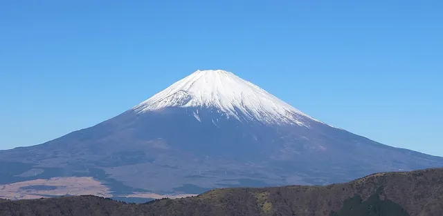
Mount Fuji’s near-perfect volcanic cone, 3,776 m (12,389 ft) and often snow-striped, is so iconic that any symmetrical stratovolcano anywhere gets its name attached. Mount Taranaki in New Zealand — about 2,518 m (8,261 ft) — resembles Fuji closely enough that it literally played the part, standing in for the Japanese mountain in the 2003 film The Last Samurai. Mayon in the Philippines and Osorno in Chile collect the same comparison, and photos of all three circulate mislabeled as Fuji.
The tell: the blemish on the perfect cone. Fuji’s southeastern flank carries a visible bulge and crater complex from the Hōei eruption of 1707 — a scar its lookalikes lack. Scale is the second clue: Fuji is a giant that rises essentially from sea level and dominates a hundred-kilometre radius, standing well over a kilometre higher than Taranaki or Mayon. If the cone is flawless on every flank and modest against its landscape, look again — and check whether the foreground says Japan at all.
Mount Rainier and its Cascade siblings
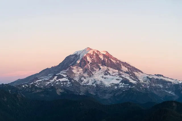
Across the Pacific Northwest, “is that Rainier?” is a perennial highway question. Mount Rainier — traditionally 4,392 m (14,410 ft), with recent surveys shaving a few metres off as its summit icecap melts — shares the skyline with a family of white volcanoes: Mount Adams at about 3,743 m (12,281 ft) is the one most often mistaken for it, and Mount Baker and Mount Hood get swapped in from other angles. From a moving car, one big glaciated cone looks much like another.
The tell: the broken shoulder. Rainier carries Little Tahoma, a jagged satellite peak of about 3,395 m (11,138 ft), on its eastern flank — a distinct dark fang sticking out of the mountain’s profile from most angles around Puget Sound. Rainier also reads as a massive, slightly flattened dome smothered in ice, while Adams is a longer, humped ridge with a broader, gentler summit. No fang, modest ice, long flat top: you’re probably looking at Adams.
Everest, upstaged in its own portrait
The strangest entry on this list: the world’s highest mountain is regularly misidentified in photos taken by people who traveled specifically to see it. From the Everest Base Camp trek and the celebrated viewpoint of Kala Patthar, the mountain that dominates the frame is usually Nuptse — 7,861 m (25,791 ft), but standing much closer to the trail — while nearby Pumori, at 7,161 m (23,494 ft), also looks enormous from Kala Patthar itself. Perspective does the rest: countless “my first view of Everest” photos are actually Nuptse’s summit.
The tell: the black pyramid at the back. Everest’s summit pyramid is dark, exposed rock — its uppermost slopes hold surprisingly little snow — and it frequently trails a white plume of wind-blown ice, a banner betraying jet-stream winds at 8,848.86 m (29,031.7 ft). Nuptse is the sharper, snowier, nearer wall. In the classic Khumbu view, Everest is the dark head peering over Nuptse’s shoulder, not the dramatic foreground star.
Mont Blanc and the impostor dome
Western Europe’s highest summit hides from its own valley. From many spots around Chamonix, the point that appears highest is the Dôme du Goûter, a satellite dome of about 4,304 m (14,121 ft) that stands closer to the valley — while Mont Blanc’s true summit, 4,805.59 m (15,766 ft) by the 2023 survey, sits farther back and can look deceptively low or hide entirely behind its outliers. Tourists photograph the wrong bump constantly, and it’s hard to blame them: foreshortening from directly below is merciless.
The tell: the farthest, roundest snow. Mont Blanc’s summit is a smooth, pure-white dome of snow — no rock at the top — set behind the nearer skyline rather than on it. If the “summit” you’ve framed from Chamonix shows rock bands near the top or sits directly above the town, you’ve likely caught the Goûter side of the massif instead. From farther away — the Geneva basin, or across the valley heights — the true summit finally separates and the massif sorts itself out.
The pattern behind commonly misidentified mountains
Every mix-up above has the same anatomy: a famous silhouette, a plausible stand-in, and a viewer relying on shape alone. The fix is also always the same — one distinguishing detail plus one location check beats a thousand vibes-based captions. Our pillar guide to identifying any mountain walks through that method in full, and the app compresses it to a single step: point the camera, and the skyline match tells you whether you’ve got the bent horn of the Matterhorn or a very handsome impostor — before the wrong name ends up under your photo.
The real peaks
Genuine photographs of the summits above — so you know what to actually look for:
Sources
- Matterhorn — Wikipedia
- Mount Assiniboine — Wikipedia
- Ama Dablam — Wikipedia
- Mount Fuji — Wikipedia
- Mount Taranaki — Wikipedia
- The Last Samurai Filming Locations — newzealand.com
- Mount Rainier — Wikipedia
- Mount Adams (Washington) — Wikipedia
- Little Tahoma — Wikipedia
- Nuptse — Wikipedia
- Kala Patthar — Wikipedia
- Mount Everest — Wikipedia
- Mont Blanc — Wikipedia
- Dôme du Goûter — Wikipedia