
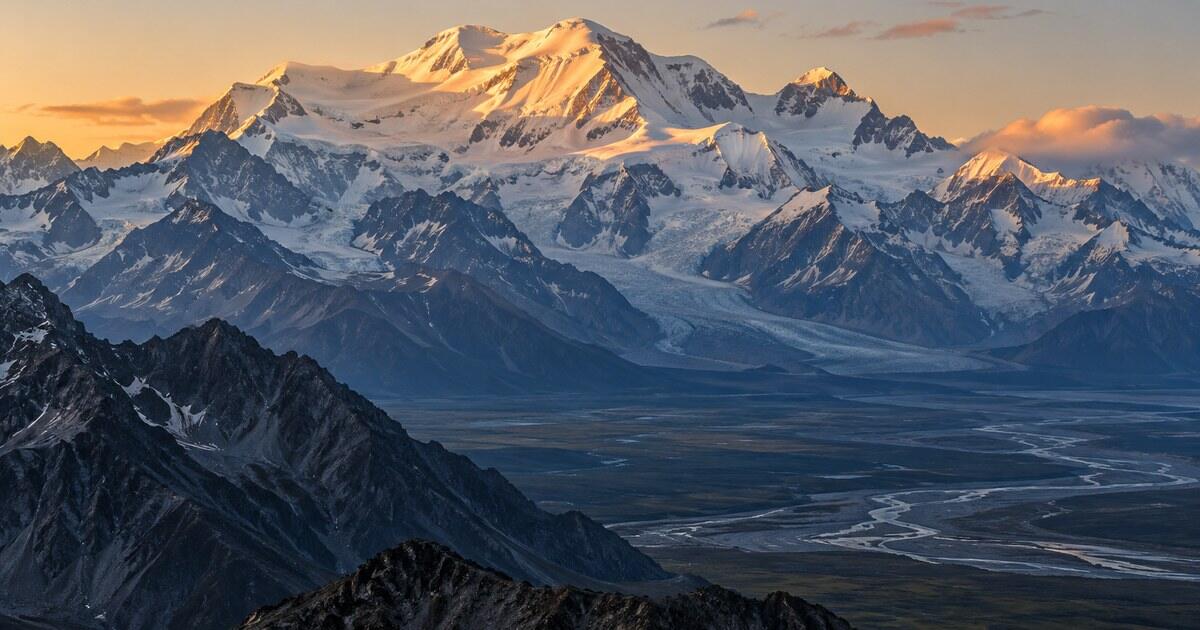
Type “tallest mountain in the US” into a search bar and the answer comes back in under a second: Denali. That answer is correct. It is also only one of four correct answers, because “tallest” hides at least four different rulers, and each of them crowns a different American mountain. Which one you mean depends on whether you care about sea level, about the lower 48, about the ground a mountain actually stands on, or about the ocean floor.
The tallest mountain in the US is Denali in Alaska, at 6,190 m (20,310 ft) above sea level, the figure set by a 2015 GPS survey. In the lower 48 states the highest is Mount Whitney in California, about 4,421 m (14,505 ft). Measured from its base on the seafloor, Hawaii’s Mauna Kea is taller than both.
Here are all four answers, what each one measures, and why the one you pick changes the picture of the country’s mountains quite a lot.
What is the tallest mountain in the US above sea level?
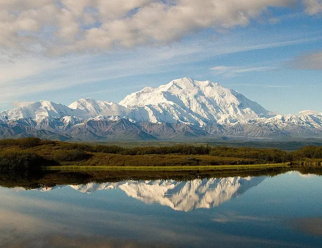
By the ordinary definition, highest summit above sea level, the answer is Denali. For decades the official figure was 20,320 ft. In 2015 a survey team carried modern GPS equipment to the summit and the published height became 20,310 ft (6,190 m), ten feet lower, which the AP reported alongside the restoration of the Denali name that same year. The name has moved again since: in January 2025 a presidential executive order changed the federal name back to Mount McKinley, while the national park around it remains Denali National Park and Preserve and Alaska’s official name for the mountain remains Denali. Same mountain, same height. The full story of the re-survey and the names, and of why the mountain is so hard to see in person, is in our profile of Denali, North America’s highest.
What surprises people is how far ahead Alaska runs. The standard list of the highest US summits with at least 500 m of prominence puts Denali first, Mount Saint Elias second at about 5,489 m (18,009 ft), and Mount Foraker third at about 5,304 m (17,400 ft). Every one of the top ten on that list is in Alaska. The first summit outside the state does not appear until eleventh place.
The Alaska Range and the Saint Elias Mountains are not simply a little higher than the Rockies and the Sierra Nevada; they are a different category of mountain range, with several summits above 4,500 m (about 15,000 ft) that most Americans could not name.
The highest mountain in the lower 48: Mount Whitney
Take Alaska and Hawaii out of the question and the answer is Mount Whitney, on the crest of the Sierra Nevada in California. NASA’s Jet Propulsion Laboratory describes it as the highest point in the contiguous United States, at 4,421 m (14,505 ft).
Whitney is a good example of a height that keeps moving without the mountain doing anything. The brass survey disk on the summit is stamped 14,494 ft, and an older plaque reads 14,496.811 ft, both measured against the 1929 vertical datum. Recalculated against the 1988 datum the same point comes out at about 14,505 ft, the figure in use today. Nothing grew. The newer number reflects a different vertical datum, the reference surface that “sea level” is measured from, and better instruments. When two sources disagree by a few feet on a big summit, that is almost always the reason.
Whitney is also a lesson in why the highest mountain does not always look like the highest. From the town of Lone Pine, on the east side of the range, the summit sits well back behind the front of the Sierra, and closer peaks stand in front of it. Foreshortening makes nearer, lower summits appear taller than the real high point, and photographing the wrong summit as Whitney is an easy and common mistake. Height is a fact about the mountain. Apparent height is a fact about where you are standing.
Two more Whitney numbers put it in context. Its summit is roughly 136 km (85 mi) from Badwater Basin in Death Valley, the lowest point in North America, so the highest and lowest points of the lower 48 sit within a long day’s drive of each other. And it clears Colorado’s highest summit, Mount Elbert, by only about 20 m (65 ft).
The most prominent mountain in the lower 48: Mount Rainier
Height above sea level is not the only way to be the tallest. The second ruler is prominence: how far a summit rises above the lowest contour line that separates it from any higher ground. It measures how much of a mountain is its own, rather than the shoulder of a bigger neighbour. If that definition is new, elevation vs prominence explains it with worked examples.
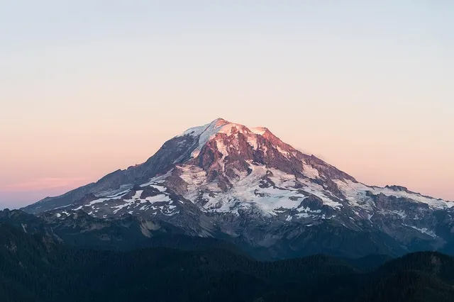
By prominence, the champion of the contiguous United States is Mount Rainier in Washington. Its elevation is 4,392 m (14,410 ft) according to the National Park Service, a little lower than Whitney. But its prominence is about 4,026 m (13,210 ft), against roughly 3,072 m (10,080 ft) for Whitney. Rainier rises from near sea level in the Puget Sound lowland, so almost all of its height belongs to it alone.
That is the number your eyes respond to. Whitney is a high point on a high range, one summit among many along the Sierra crest. Rainier is a solitary volcano standing over a lowland, which is why it dominates the Seattle skyline from roughly 100 km away. If you want the version of “tallest” that matches the feeling of standing in front of a mountain, prominence is usually it. Our guide to how tall Mount Rainier is goes deeper on why.
Denali, for the record, wins this contest nationally too. Its prominence of more than 6,100 m is among the highest of any mountain on Earth, because nothing in North America stands higher to connect it to.
The tallest from base to summit: Mauna Kea
The fourth ruler measures a mountain from its base rather than from sea level, and it produces the answer that shows up in trivia books. The U.S. Geological Survey describes Mauna Kea, on the Big Island of Hawaii, as reaching 4,207 m (13,803 ft) above sea level and as the tallest mountain on Earth when measured from its base on the ocean floor. Most of the volcano is underwater. Measured from the seabed, its total height is commonly given as a little over 10,000 m, more than Everest’s height above sea level.
On land, base-to-summit rise hands the title back to Denali. The National Park Service describes it rising from lowlands at about 600 m (2,000 ft) to its summit, a rise of roughly 5,500 m (18,000 ft), one of the greatest continuous rises of any mountain on land anywhere. The full comparison, with the honest caveat that a “base” is always a judgment call, is in base to peak, the list where Denali beats Everest.
So which is the tallest mountain in the US?
If someone asks at a pub quiz, say Denali and move on. It wins on the default ruler and on two of the other three.
If they ask about the lower 48, the answer is Whitney by height and Rainier by prominence, and the difference between those two is the difference between a number on a map and a mountain on a skyline. If they ask about the whole mountain, including the part underwater, it is Mauna Kea.
| Question | Winner | The number |
|---|---|---|
| Highest above sea level, all 50 states | Denali | 6,190 m (20,310 ft) |
| Highest above sea level, lower 48 | Mount Whitney | about 4,421 m (14,505 ft) |
| Most prominent, lower 48 | Mount Rainier | about 4,026 m (13,210 ft) prominence |
| Tallest base to summit, including seafloor | Mauna Kea | 4,207 m (13,803 ft) above sea level; over 10,000 m from the seabed |
None of these is a trick answer. They are four honest measurements of four different things, and a good mountain fact always tells you which ruler it used.
The same goes for the peak in front of you on a trail or out of a car window. A summit can be the highest in view without being the highest in the range, and a nearer shoulder can look taller than both. Point your camera at it and the app will tell you which one you are actually looking at, with its elevation and its prominence side by side.
The real peaks
Genuine photographs of the summits above — so you know what to actually look for:
Sources
- North America's Tallest Mountain Gets New Name, and Height (AP via VOA News)
- List of mountain peaks of the United States — Wikipedia
- NASA's Terra Spacecraft Views Mt. Whitney, the Highest Point in the Contiguous United States — NASA JPL
- Badwater Basin — Death Valley National Park, National Park Service
- Mount Rainier National Park — National Park Service
- Mauna Kea — U.S. Geological Survey, Hawaiian Volcano Observatory
- New Elevation for Nation's Highest Peak — U.S. Geological Survey
- The High One (Denali geology and facts) — Denali National Park and Preserve, National Park Service
- Mauna Kea — Wikipedia
- Denali–Mount McKinley naming dispute — Wikipedia
- Mount Whitney — Wikipedia