Most of the world’s biggest mountains come with an entourage. The Himalayan giants stand shoulder to shoulder; the Alps are a crowd. Kilimanjaro is the great exception: a single enormous massif rising straight out of the East African plains, visible for a hundred kilometres with nothing beside it to steal the frame. Understanding why Kilimanjaro is so tall — and so alone — is one of the most satisfying stories in mountain geography.
Kilimanjaro is so tall because it is a stratovolcano that built itself up, eruption by eruption, from the East African plains to 5,895 m (19,341 ft). Because no comparably high ground stands anywhere near it, it is the world’s highest free-standing mountain — its prominence essentially equals its entire elevation.
Why Kilimanjaro is so tall: a mountain that made itself
Kilimanjaro wasn’t pushed up by colliding continents the way fold ranges like the Alps or Himalaya were. It’s a volcano — or more precisely, three volcanoes fused into one massif, each a separate vent that stacked lava and ash onto the same growing pile.
The three cones tell the construction history in order:
- Shira, the oldest, is extinct and heavily eroded — what remains is a broad plateau around 4,005 m (13,140 ft) forming the mountain’s western shoulder.
- Mawenzi, also extinct, is the jagged eastern spire at 5,149 m (16,893 ft) — a shattered, rocky silhouette utterly unlike its neighbour.
- Kibo, the youngest and highest, is the smooth summit dome that carries Uhuru Peak at 5,895 m (19,341 ft).
Kibo is the reason the mountain still tops out where it does — and it isn’t finished in the geological sense. It’s classified as dormant rather than extinct: its last major activity came roughly 150,000 to 200,000 years ago, when the present summit crater formed, and fumaroles in the crater still vent gas today. No eruption is expected on any human timescale, but the mountain’s architect is asleep, not gone.
So the direct answer to “why so tall” is simply: repeated eruptions kept adding height for far longer than erosion could take it away, through three successive vents, and the youngest one built a dome nearly six kilometres above the sea.
Why it looks even taller than it is
Here’s the part that elevation alone can’t explain. On paper, Kilimanjaro is nowhere near the world’s highest summit — dozens of Himalayan and Karakoram peaks exceed it. Yet almost nothing on Earth looks bigger from the ground.
The reason is prominence — the measure of how far a summit rises above everything connected to it, which we unpack fully in elevation vs prominence. Kilimanjaro rises from plains that sit far below it, with no higher terrain for a very long way in any direction, so its prominence is effectively its entire height — Wikipedia lists the full 5,895 m, ranked 4th greatest on Earth. Only Everest, Aconcagua and Denali stand more independently. An 8,000 m Himalayan peak might show you three or four kilometres of relief above its already-high valleys; Kilimanjaro shows you essentially all of itself.
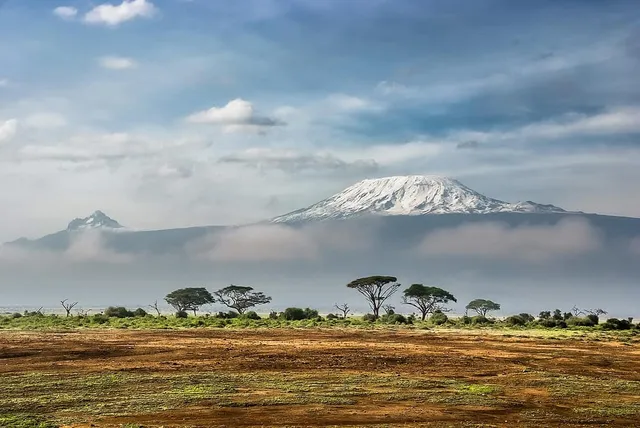
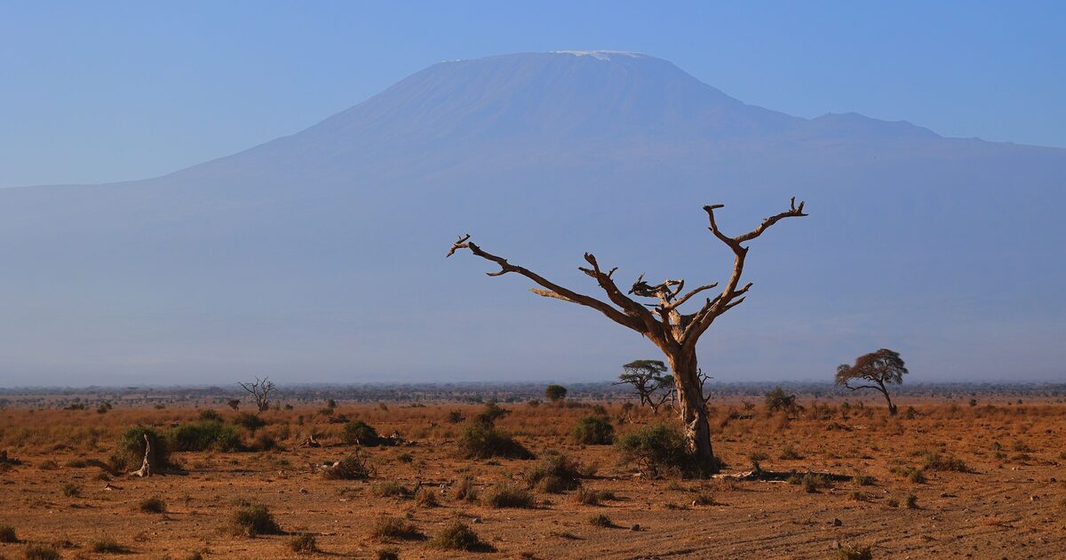
That’s why the mountain so thoroughly owns the Amboseli skyline. From the plains on the Kenyan side, the classic view stacks acacia trees and elephants against a wall of mountain that begins at savanna level and ends in ice — a single uninterrupted rise with no foothills, no neighbouring ridge, no foreground range to break the scale. Free-standing geology is the postcard: the volcano built its full height in one place, and prominence is the number that captures what your eye experiences there.
It’s also why Kilimanjaro is one of the easiest major summits on Earth to identify with confidence, and a fixture on our list of the most recognizable mountains: a lone, flat-topped, snow-capped dome three degrees south of the equator has no plausible impostors.
The shrinking crown
The white summit that defines every photograph is in rapid retreat. Kibo’s ice cap has been shrinking for over a century: almost 85 percent of the ice cover disappeared between October 1912 and June 2011, from about 11.4 km² down to under 1 km². Researchers have projected the remaining glaciers could vanish within decades, though exact timelines vary between studies — an honest source keeps that hedge.
For mountain-watchers this has a practical consequence: photographs of Kilimanjaro age quickly. A summit picture from the 1990s shows visibly more ice than one from this decade, and the “eternal snows” of older travel writing are no longer a reliable identification mark in every season. The mountain’s shape — that lone dome-and-spire profile of Kibo and Mawenzi — is now a better signature than its snow.
There’s a viewing lesson buried in that, too. Around Amboseli and Moshi the giant plays hide-and-seek: warm days build haze and cloud around the massif, so the reliable windows are dawn and dusk, when the air is cool and the plains release their heat. Travelers regularly spend a first day convinced the mountain is a myth, then step outside at sunrise to find it hanging over the horizon, improbably high — often above the cloud layer they’d mistaken for sky.
Reading the giant
Kilimanjaro rewards the two-number habit. Its elevation, 5,895 m (19,341 ft), tells you it’s Africa’s highest point. Its prominence — the same figure — tells you why a mountain that wouldn’t crack the Himalayan top fifty can nonetheless deliver one of the most overwhelming sights in the natural world. One number is about the air at the summit; the other is about what you see from the plain.
If you’re ever standing in the savanna wondering whether that impossibly large shape on the horizon can really be it, point the app at the skyline. It will name the peak, show both numbers side by side, and confirm what your eyes suspected: yes, all of that is one mountain.
The real peaks
Genuine photographs of the summits above — so you know what to actually look for: