Serious peak lists carry three numbers, and most people only ever read the first. Elevation gets the headlines, prominence gets the enthusiasts, and the third — isolation — barely gets mentioned. Which is a shame, because if you’ve ever wondered what is topographic isolation actually measuring, the answer is the most intuitive of the three: how alone a mountain really is.
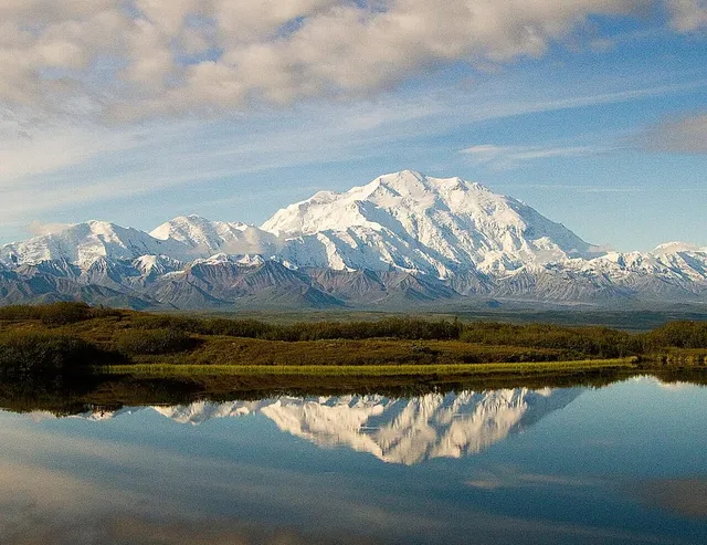
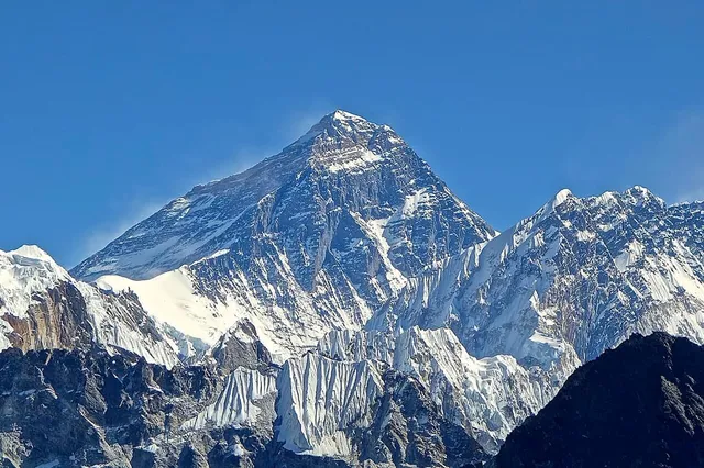
Topographic isolation is the distance from a mountain’s summit to the nearest point of equal or higher elevation. It answers a simple question: how far would you have to travel to stand this high again? Everest’s isolation is effectively infinite — there is nowhere higher to go — while Denali’s is about 7,440 km (4,620 mi).
Once you can read all three numbers together, a peak’s statistics stop being trivia and start being a portrait. Here’s how the third one works.
Topographic isolation, defined in plain English
Take any summit. Now search the entire planet for the nearest spot — any spot, summit or slope — that is at least as high. The straight-line distance from your summit to that spot is its topographic isolation. The place itself is sometimes called the isolation limit point, and it usually isn’t a summit at all; more often it’s a point partway up the flank of some bigger mountain.
A small worked example: a 1,000 m hill five kilometres from a 2,000 m mountain has an isolation of roughly five kilometres — that’s how far you’d travel to be 1,000 m up again, on the bigger mountain’s shoulder. The same 1,000 m hill in the middle of a vast plain, hundreds of kilometres from higher ground, might have an isolation of hundreds of kilometres. Same height, utterly different presence: isolation is the number that captures the difference.
That’s also why isolation resonates with how mountains feel in person. A summit with huge isolation is the definition of “you can see it from everywhere” — it owns a radius, not just a skyline.
Everest, the peak with no higher ground anywhere
Every measurement system has an edge case, and for isolation it’s Mount Everest. At 8,848.86 m (29,031.7 ft) there is no point of equal or higher elevation anywhere on Earth, so the search that defines isolation never finds a target. By convention, lists either leave Everest’s isolation blank or call it infinite — some quote the antipodal distance, roughly 20,000 km, as a tongue-in-cheek maximum. Either way, Everest tops the isolation table the same way it tops the prominence table: by definition rather than by measurement.
Second place is more interesting. Aconcagua, the 6,961 m (22,838 ft) high point of the Andes and of the entire Western Hemisphere, has no higher land for about 16,534 km (10,274 mi) — you’d have to travel from Argentina to the Himalaya to stand higher. Denali sits third, and the pattern holds: the isolation leaderboard is essentially a list of continental and island high points, because those are the peaks with nothing above them for enormous distances.
Three rulers, three different questions
It’s worth being precise about how the three numbers differ, because they’re often blurred together.
Elevation asks: how high is the summit above sea level? It’s a number about air — altitude, oxygen, snowline — and says nothing about the view.
Prominence asks: how far down would you go before you could climb higher? It measures vertical independence — how much of the mountain belongs to the mountain — and we’ve covered it in detail in elevation vs prominence.
Isolation asks: how far away is higher ground? It measures horizontal independence — the radius a peak dominates.
The three don’t have to agree, and that disagreement is informative. A high-elevation shoulder in a big range scores badly on both prominence and isolation. A modest island volcano can post a small elevation, respectable prominence, and enormous isolation. K2 has the world’s second-greatest elevation but sits deep among Karakoram giants, so its prominence is middling for its height, and its isolation ends not at some distant continent but on the slopes of Everest itself — the only terrain on Earth that stands higher. Numbers like that sketch the geography before you’ve seen a photo.
Working all three numbers: Denali
Run the full report card on Denali and you can practically see the mountain assemble itself.
Elevation: 6,190 m (20,310 ft) — the highest point in North America, per the 2015 USGS re-survey.
Prominence: 6,144 m (20,156 ft) — third greatest on Earth. Its key col, the lowest point on the highest route to bigger terrain, lies far away in Central America, which is a way of saying that almost the entire mountain stands on its own.
Isolation: about 7,440 km (4,620 mi) — also third greatest on Earth. From Denali’s summit, the nearest place as high as your boots is across the Pacific in the high ranges of Asia.
Read together: a mountain nearly as tall as the Andes’ best, that keeps essentially all of its height as prominence, with no peer on its own continent — or the next one over. That is exactly the mountain that greets you: a colossal, solitary white mass that dominates the horizon from hundreds of kilometres away. The three numbers told you before the photo did.
What isolation tells you when you’re reading a skyline
For identification, isolation is the confidence number. When a summit has big isolation, nothing nearby can be mistaken for it — if you’re anywhere in south-central Alaska looking at something impossibly large and white, the shortlist has one entry. Low-isolation peaks are the opposite: the crowded fields where lookalikes live and misidentifications happen.
Every result in the app carries the full report card — elevation, prominence, range, country — so when you point your camera at a distant giant you get the portrait, not just the height. One number tells you how high a mountain is. Three numbers tell you what it’s like.
The real peaks
Genuine photographs of the summits above — so you know what to actually look for: